The complete guide to the Banff to Jasper drive, with every stop, the real access rules, and what twenty years of return visits have changed about the most beautiful road in Canada.
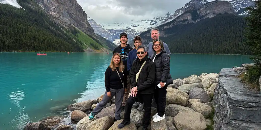
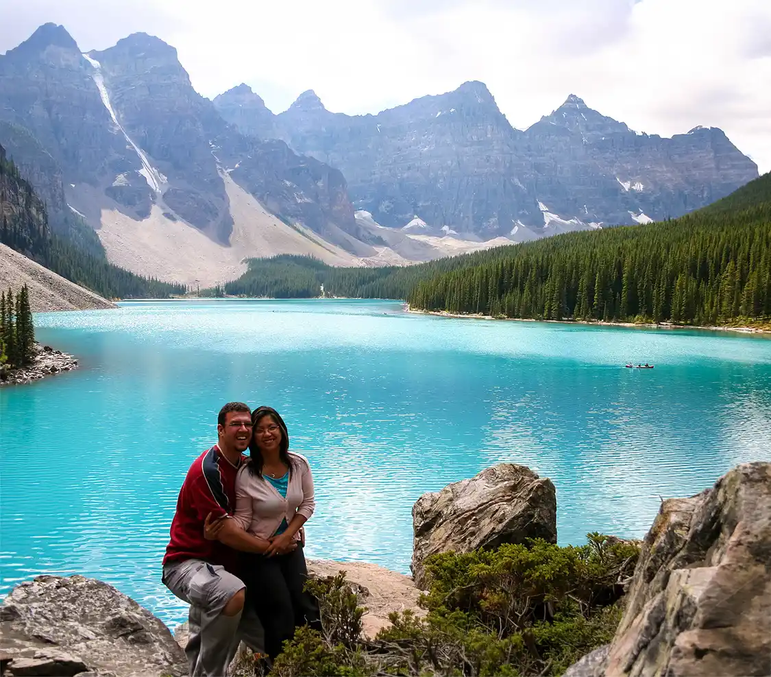
I have two photographs of the same patch of rock at Moraine Lake, each taken twenty years apart. In the first, from 2006, Christina and I are standing at the shoreline with our arms around each other. Two young kids grinning at a camera balanced precariously on a rock just out of frame. We had the place more or less to ourselves, which isn’t something anyone can say about Moraine Lake anymore, in any season.
As the timer clicked, a tiny little pika crawled out from beneath a pile of rocks. If you’ve never seen one, picture a potato with round ears and no tail, about the size of your fist, with a squeak wildly out of proportion to the size of its body. It sat there and stared at us like it was trying to work out why anyone would be walking up to its doorstep.
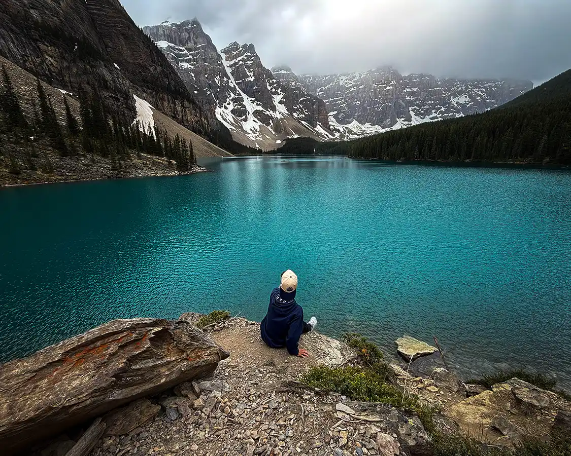
In the second photo, from this past summer, Dylan is sitting alone on that same rock with his back to me. Twelve years old, looking out at all that impossible blue hue that Moraine Lake has become so famous for. He’d climbed down there to get away from the crowds. The boys and I had hiked up the rockpile first, and no animal came to visit. There were far too many people up there for any creature with sense to show itself.
In twenty years, the view hasn’t changed at all. That perfect chain of snow-capped mountains. The mirror lake, hazy blue from glacier runoff. The view might be the same, but the experience has changed completely, and that gap is the real story of what driving Canada’s most iconic road trip is really like.
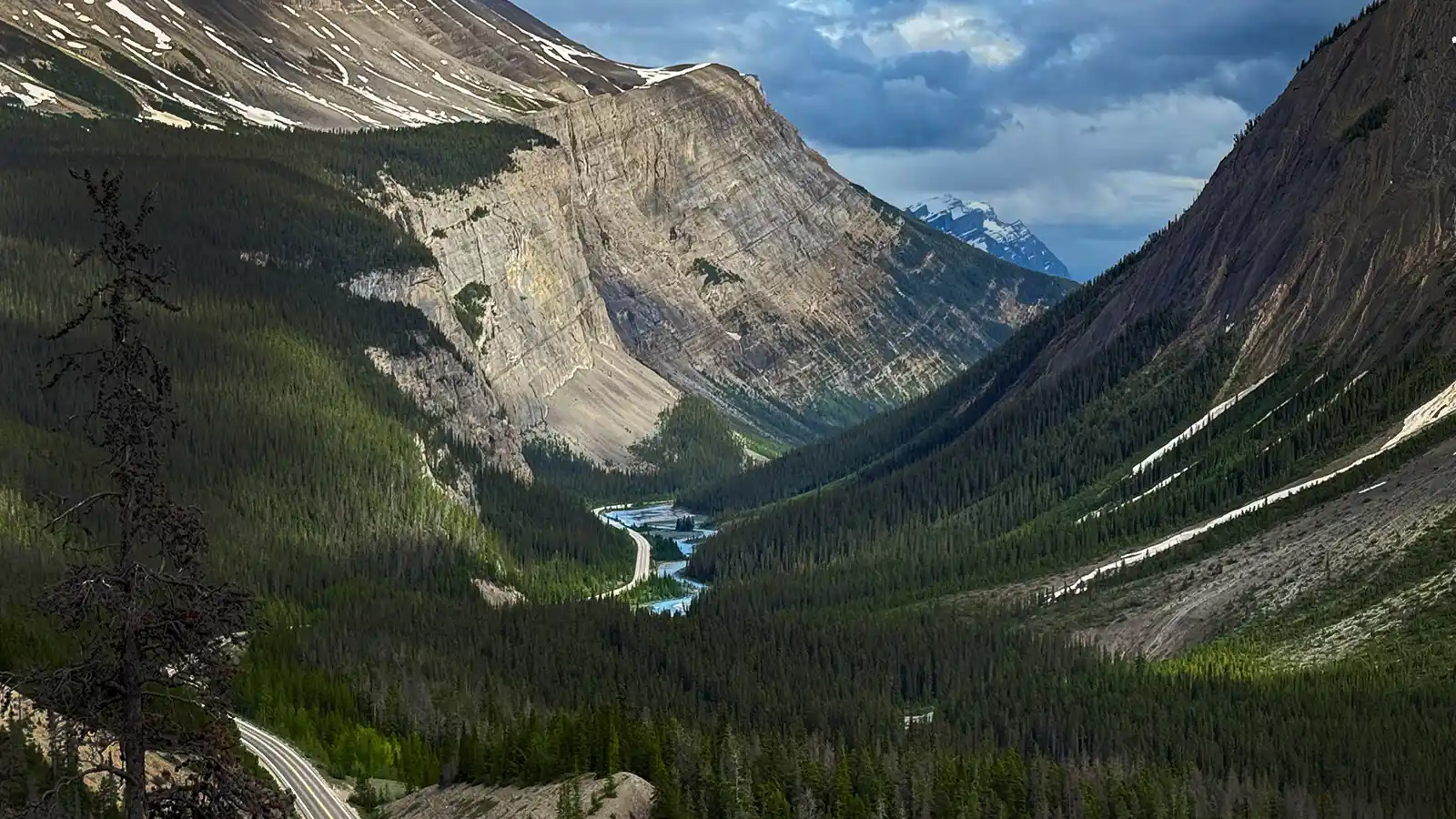
The 288 kilometers (179 miles) of Highway 1 and Highway 93 that connect the towns of Banff and Jasper are often called ‘one of the most beautiful drives on earth,’ and for once the marketing is kind of underselling it. You can do the whole thing in three and a half hours if you keep your foot down and your eyes forward, which is the single biggest waste of a Canadian Rockies road trip I can imagine.
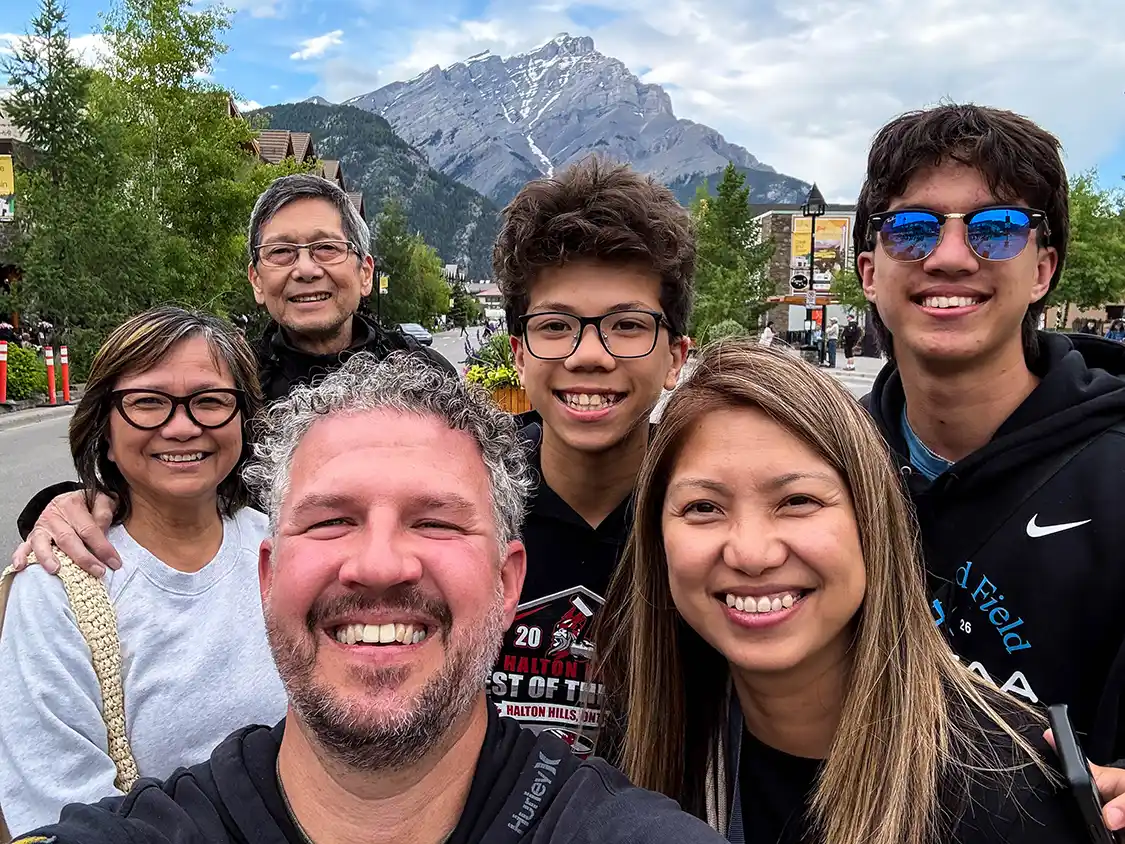
I’ve driven this route a few times now, across two decades. The first was just Christina and me, a little over a year before we got married, two young keen-eyed kids at the start of a life together that would bring them two incredible young men and travels through more than 60 countries across five continents. The latest was this past summer with Christina, our boys Cohen and Dylan, and Christina’s parents Felix and Maria. Seven people, three generations, one road, two completely different experiences.
If you want the broader picture of the region first, start with my Banff family travel guide, and if wildlife is what you’re really here for, I’ve written a separate guide to spotting wildlife in the Canadian Rockies.
This road trip guide covers every stop worth making between Banff and Jasper, in the order you’ll reach them driving north. It also covers the things that have changed, which is more than you’d think. If you’re driving from Jasper to Banff, just start at the bottom of this guide and work your way up. The experiences are the same, just in a different order. If you’re new to road trips, especially family road trips, you might want to have a quick read of my family road trip packing list before you head out.
Banff to Jasper Drive: Quick Planner
Distance and time: 288 km (179 miles) from Banff to Jasper, or 232 km (144 miles) from Lake Louise. Three and a half hours without stopping. Eight to ten hours if you do it properly, which you should.
Best for: Mountain scenery that doesn’t let up for three hours, glacier access by road, and the best roadside wildlife viewing in Canada. It suits three-generation groups unusually well, because most of the great viewpoints are a short walk from the car.
Top three unmissable stops: Peyto Lake, the Columbia Icefield and the Athabasca Glacier, and Moraine Lake. If you have time for a fourth, make it Horseshoe Lake, which almost nobody writes about.
Best overnight bases: Banff or Canmore at the south end, Lake Louise in the middle if you can get a room, and Jasper at the north end. Saskatchewan River Crossing is the only thing resembling a midpoint, and it’s a fuel stop with beds rather than a destination.
Can you do it in a day? Yes, but I don’t recommend it. Leave Banff by 7 am if you must, pick six stops, and accept that you’ll arrive in Jasper in the dark. Two days is the honest minimum. Three lets you breathe.
Plan ahead alerts: You cannot drive to Moraine Lake. You need a Parks Canada pass. There’s one fuel stop in 232 km, and it’s seasonal. There’s no cell service on the Parkway. Maligne Canyon and Mount Edith Cavell are closed indefinitely after the 2024 Jasper wildfire.
Driving Jasper to Banff: Everything here works in reverse. Each stop below carries its distance from both ends, so if you’re driving Jasper to Banff, read the second number and the list from the bottom up.
About The Banff To Jasper Drive
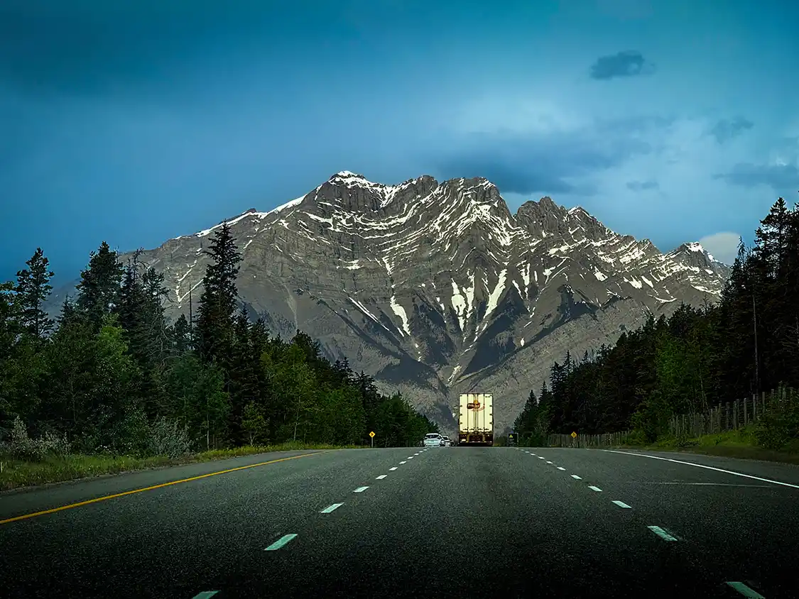
The Banff to Jasper drive has a problem that most scenic drives never have to worry about. The problem isn’t finding something worth stopping for. It’s that there is so much to see along the way that it’s pretty much impossible to check everything off.
Most scenic drives follow a pattern. A viewpoint, then a forty-minute gap of trees, then another viewpoint. Between Banff and Jasper, there are very few gaps. You descend into a canyon, and there’s a glacier hanging off a cliff like it was bolted there. You round a bend, and there’s a turquoise lake that, if it were anywhere else, would cause a traffic jam. An hour in, your jaw starts to hurt from gaping. Two hours in, you’re driving straight past things that would be the centerpiece of a national park in any other country. There’s so much to see that you start raising the baseline for amazement.
That’s my honest opinion on why giving this drive more than a day makes sense. When I drove it in 2006, Christina and I planned to drive from Banff to Jasper and back in a day. We didn’t make it. We ended up rolling into Jasper after dark, exhausted and booking the only room left in the entire town. The honeymoon suite at Jasper Inn and Suites was all that was left. It had a king-sized bed, a heart-shaped hot tub, and free breakfast. We didn’t use any of it. We paid the $500 bucks, which at the time was a terrifying amount for a young couple, and passed out. Leaving the next morning before sunup for the return drive to Banff.
We learned our lesson. When I made the drive in 2026 with my family, we took two days to drive from Banff to Jasper, stopping at Sunwapta Falls Rocky Mountain Lodge on the way up. Then we took the better part of a day to drive back from Jasper to Banff. Everything about that made it better, more relaxing, and gave us a much better chance to appreciate everything that we saw along the way.
The route is simple enough. From Banff, you run 58 km north to Lake Louise, either on the Trans-Canada or, far better, on Highway 1A, the Bow Valley Parkway. At Lake Louise, you pick up Highway 93 North, and that’s the Icefields Parkway, 232 km of it, running all the way to Jasper.
The whole route exists because of the Great Depression. Crews cut it through here as relief work in the 1930s, and if you find yourself at a viewpoint wondering how on earth anybody got a road into this valley, that’s your answer.
About two-thirds of the way along, it runs directly beneath the Columbia Icefield, the largest body of ice in the Rocky Mountains, which sheds meltwater into three separate oceans. You can stand at the toe of the Athabasca Glacier and put your hand on it. There is nowhere else in North America where a road delivers you that close to that much ice.
What Is The Distance Between Banff And Jasper?
The road trip between Banff townsite and Jasper townsite covers about 288 kilometers, or 179 miles. The Icefields Parkway portion, Lake Louise to Jasper, is 232 km (144 miles). Allowing for the 58 km from Banff up to Lake Louise, Google will tell you three and a half hours, which is “technically” correct but worth ignoring. Because Google doesn’t stop when a grizzly bear is scavenging for berries at the side of the road.
Parks Canada suggests allowing three to four hours for the Parkway alone before you add a single stop. Our last run took the better part of ten hours, and we skipped a lot of things along the way. Traveling as a group, the limiting factor wasn’t the driving. It was that everybody needed a bathroom at a different viewpoint.
Tips For Driving From Banff To Jasper
I’ve laid out some tips from first-hand experience driving between Banff and Jasper. But before I get into the details, there’s one important item that I want to emphasize first. IF you’re taking a family road trip, I recommend reading my family road trip packing list, which has everything you need before you head out on the Banff to Jasper trip.
- Fuel up before you go. There is one single gas station between Lake Louise and Jasper. It’s located at Saskatchewan River Crossing, 108 km north of Lake Louise. It’s seasonal, operating roughly April or May through October, and it closes for the winter. Parks Canada’s own winter guidance states plainly that there are no services across the 230 km between Jasper and Lake Louise. Fill your gas tank in Banff or Jasper and treat the Crossing as a bonus rather than a plan. Expect to pay a generous rate if you do use it, because they know exactly what they’ve got.
- There’s no cell service. You get coverage at each end of the Parkway and very little in between. Download offline maps before you leave. If your plan involves looking something up halfway, you’re going to have trouble.
- You need a Parks Canada pass. Highway 93 North runs entirely inside Banff and Jasper National Parks, so there’s no through-traffic exemption. A daily family or group pass covers up to seven people in one vehicle, which for a family or group traveling together is the single best value in the Rockies. If you’re staying a week or visiting other parks in the Rockies, the annual Discovery Pass breaks even at about seven days. Buy it online in advance and print it, because a screenshot on a phone is not always accepted at the gate.
- Leave early. Not for the light, though the morning light is spectacular. For the parking. The lots at Peyto Lake, Lake Louise and Athabasca Falls fill by mid-morning in summer, and there is nowhere else to park. You don’t want to waste valuable time on this drive waiting for a parking space to open up.
- Use the bathroom when you can. Washrooms with full plumbing exist only at Lake Louise, Saskatchewan River Crossing, the Icefield Centre and Jasper. Most other stops have porta-potties or pit toilets with no sink. With kids or grandparents, this matters more than any viewpoint.
- Pack a cooler. Between Lake Louise and Jasper, your food options are limited to Saskatchewan River Crossing, the Icefield Center, and Sunwapta Falls Resort. That’s pretty much it, across 232 km. A carload of people cannot be fed spontaneously out here.
- Dress for the top, not the bottom. You can leave Banff in the mid-twenties Celsius and be standing in near-freezing wind at the Columbia Icefield three hours later. The Parkway climbs to 2,068 m at Bow Summit. Bring a real jacket even in July, and bring one for everyone (the person who insists they’ll be fine is lying, and a lot of the time, that’s me).
- Check the road before you go, every time. Alberta 511 at 511.alberta.ca, or 1-855-391-9743. The Parkway is open year-round but closes unpredictably for avalanche control and weather, sometimes for a full day. Winter tires or chains are legally required from 1 November to 31 March; plowing runs only 7 am to 3:30 pm, and Parks Canada actively advises against using this road as a Trans-Canada alternative in winter. The detour, if it shuts, is seven to eight hours.
Watching Wildlife Responsibly Between Banff And Jasper
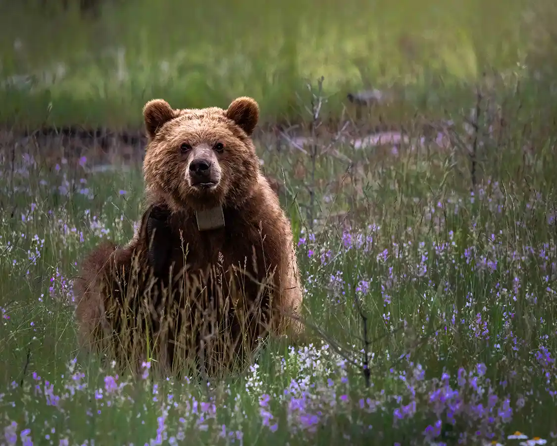
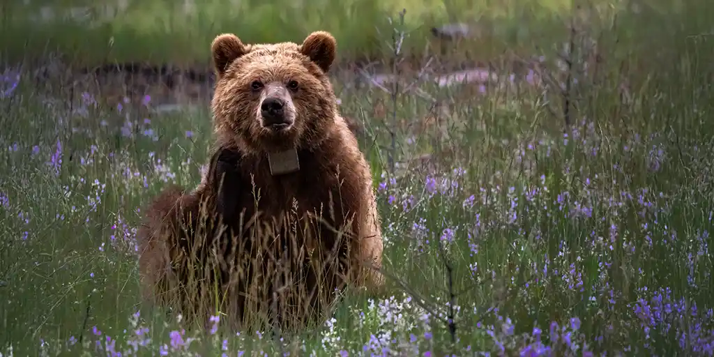
You will see animals on this drive. Across two trips we’ve had bighorn sheep at the roadside, a full-curl ram lying in the grass at Cold Sulphur Spring, and two young grizzlies shoving each other around a meadow near Lake Edith. None of that took skill. It took being on this road, and then not ruining it.
The rules here are specific, and most people don’t know them. Under the Canada National Parks Act, you have to stay at least 100 m away from bears, cougars, and wolves, and at least 30 m from elk, moose, caribou, bighorn sheep, and mountain goats. During the fall elk rut, give them 50 m or more. A hundred meters is about the length of a football field, which is a great deal farther away than it feels when you’re excited and holding up a phone.
If a large animal is close to the road, the safest place to watch it from is inside your vehicle with the windows up. I know exactly how that sounds when there’s a grizzly a few car lengths away and a camera sitting on the seat beside you. On an earlier trip in the Rockies, Christina locked the doors to stop me from getting out. She was right.
Pull completely off the road or don’t stop at all. Not half in the lane with your hazards on. Not stopped in a blind curve on the Icefields Parkway where nobody coming the other way can see you until they’re on top of you. Wildlife jams are the most dangerous thing on this entire route, and they are created entirely by us. Maligne Lake Road is the worst of them in my experience, where drivers seem to abandon all road sense the moment something with antlers steps out of the trees. The reduced speed limits and seasonal evening closures on the Bow Valley Parkway exist for exactly this reason.
Never feed an animal, and never put food out to bring one closer for a photograph. This isn’t a soft rule about etiquette. An animal that learns to associate people with food becomes a safety problem, and the way a safety problem gets solved is that the animal is destroyed. You would be the reason.
If you’re walking any of the trails on this drive, and the Valley of the Five Lakes, Johnston Canyon and the Lake Louise lakeshore all count, carry bear spray somewhere you can reach it in two seconds rather than buried in a pack, and learn how to use it before you need to. Make noise as you walk. Go in a group. I’ve carried bear spray through years of hiking in the Rockies and have never had to use it, which is the entire point of carrying it.
If you’ve got kids along, this is the part worth teaching properly. Watch quietly, from a distance, on the animal’s terms. Our boys came away from this trip with a better wildlife story than most adults manage, and they got it sitting still in a vehicle with the engine switched off.
The photo is never worth it.
For the species-by-species detail, the best places to look along this road, and how to tell a bighorn sheep from a mountain goat before you post the picture, I’ve written a full guide to wildlife in the Canadian Rockies.
The Best Stops On The Banff To Jasper Drive
I’ve laid out this road trip guide in driving order, north from Banff to just past Jasper. Each stop lists the distance from both ends of the drive, so the list works in either direction, whether you’re leaving from Banff or Jasper. And the times are measured car door to car door, including the walk, the photographs, and the inevitable argument about whether anyone needs the toilet. These are, of course, just estimates. Some stops might take longer; some you might skip altogether. But it’s good to know what kind of time investment you’re looking at before you find yourself three hours into a hike you thought was going to be a 15-minute viewpoint.
The Best Stops in Banff
Three of the best stops on this drive are behind you before you even start your road trip. If you’re starting your trip in Banff, give yourself a night and a morning in town at the bare minimum. This is one of the prettiest towns in Canada, and one of the best stops along the way.
Cave and Basin National Historic Site
2 km from Banff townsite · 290 km from Jasper · 5-minute walk from parking, boardwalks throughout · Allow 45 minutes to an hour
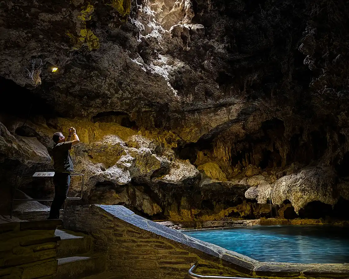
Cave and Basin is a very special place. This is where Canada’s entire national park system was born, and very few people who drive from Banff to Jasper stop here. In 1883, three railway workers found hot sulfur springs bubbling out of the side of Sulfur Mountain and tried to claim them. They ended up losing the argument with a federal government that wanted the profits for itself. Ultimately, all of Canada won when the government decided to protect the site instead of exploiting it. Everything you experience between Banff and Jasper is the result of that decision, including the road you’re about to drive.
You smell it before you see it. The sulfur hangs in the air outside the building and gets considerably stronger once you’re inside the cave itself, which is a dim, dripping chamber with a hole in the roof and water at the temperature of a warm bath. Cohen said it smelled like a rotten egg factory (accurate) and then spent twenty minutes in there anyway.
He spent most of that time looking for the Banff Springs snail, an endangered species that lives in these springs and nowhere else on the planet, which is what led to the site’s closure as a luxury spa and its birth as a conservation area.
Hours: Summer (15 May to 15 October): Open daily from 9:30 am to 5 pm. Winter (16 October to 14 May ): Open Thursday to Monday only, 11 am to 5 pm. It is closed on Tuesdays and Wednesdays all winter.
The Banff Gondola
5 km from Banff townsite · 293 km from Jasper · Gondola, then a 1 km boardwalk at the summit of Sulphur Mountain · Allow 2 to 2.5 hours if you plan on walking to the top.
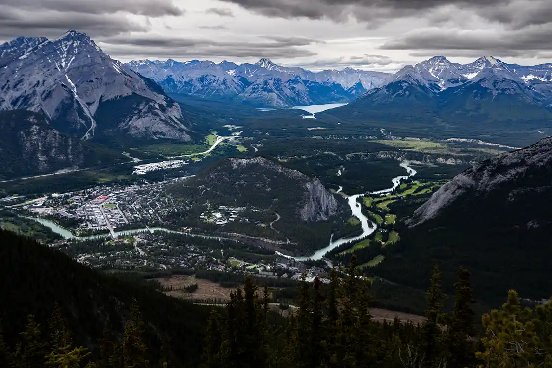
The Banff Gondola is an eight-minute ride up the side of Sulphur Mountain to a ridgeline that sits at 2,281 m. At the top is a boardwalk running along the spine to Sanson’s Peak and a view down the Bow Valley that will lay out the geography of the whole region in about four seconds in a far better way than words ever can. This is the stop that sold the mountains to Felix and Maria, because it delivers a genuine alpine summit without anybody having to climb anything.
The boardwalk is the part that matters for a mixed-ability group. It’s a kilometer of raised walkway with stairs in sections, so it isn’t flat, but it’s a world away from a scramble, and there are places to sit the whole way along. Book online in advance with a timed entry in summer, because walk-up in July is optimistic.
Lake Minnewanka
11 km from Banff townsite · 299 km from Jasper · Lakeshore is right at the parking area · Allow 30 minutes, or 2.5 hours with the cruise
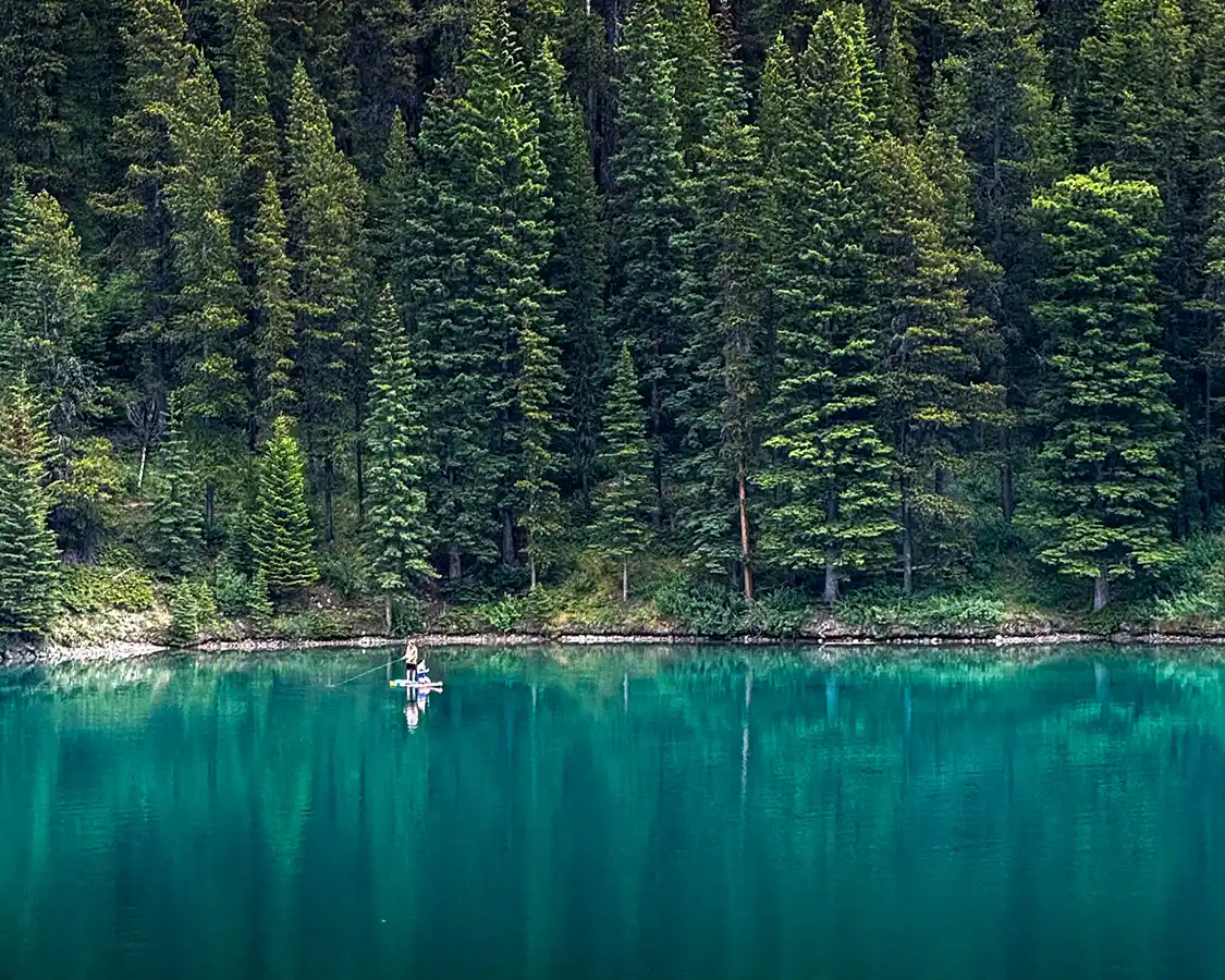
The largest lake in Banff National Park, and a complete change of character from the turquoise glacial puddles you’re about to spend three days photographing. Minnewanka is long, deep, dark, and, if I can be honest, a little ominous. The lake is hemmed in by steep walls, and there’s a drowned village at the bottom of it. Minnewanka Landing was flooded when a dam went up, and divers still go down to swim around the house foundations and the old hotel. Tell a teenager there’s a sunken town under the boat and you will have their full attention for the first time all day.
There is a lake cruise that runs here from May to October. The shoreline path is flat and easy to walk for as far as you want to take it.
Be aware: This is prime grizzly habitat. Parks Canada periodically imposes minimum group sizes on trails in this area, and those restrictions are legally enforceable where posted. Check the trailhead signage rather than assuming.
Vermilion Lakes
3 km from Banff townsite · 291 km from Jasper · Roadside pullouts, no walk at all · Allow 20 to 30 minutes
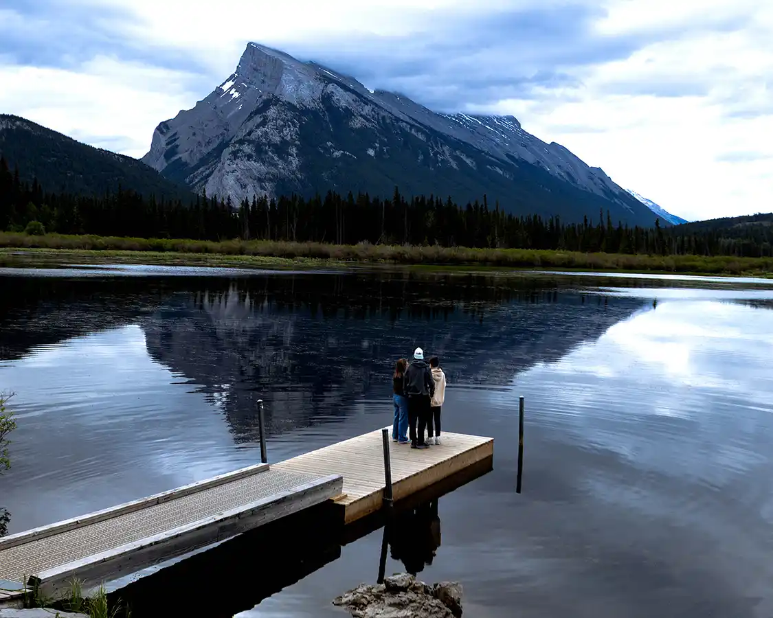
A short road out of Banff passes along three shallow lakes with Mount Rundle standing proudly in the sky above them. This is the single best wildlife spotting location in Banff. It’s not rare to see elk, bears, and deer here. The day before I was last there, a couple saw a pack of coyotes ambling along the edge. There are beavers, ospreys, muskrats, otters, mink, and, with luck and distance, grizzlies.
It’s also a sunrise and sunset spot of some repute, and because the pullouts are right on the road, it costs nothing to visit. If somebody in your group has had enough of car parks and boardwalks, it’s a spot that offers a great view just a few steps from the car door. In April 2026, Parks Canada issued a bear warning for Vermilion Lakes Road after the well-known grizzly nicknamed The Boss was seen feeding on fish carcasses along the shore. Warnings here are routine. Don’t be alarmed, but do read the signs at the entrance before you visit and stay aware while you’re there.
The Best Stops Along The Bow Valley Parkway
Most people making the Banff to Jasper drive take Highway 1, the Trans-Canada, as far as the junction with Highway 93 and the Icefields Parkway. I get it. It’s smooth, it’s fast, and the fenced-in roadsides keep the animals from wandering out onto the road. Instead, the animals get their own scenic bypass along the forested wildlife bridges that cross the highway along the way. If you want to make this drive as fast and as boring as possible, that’s the route I’d suggest.
But I think you’re here for something more. Something that will make the road trip between Banff and Jasper absolutely legendary. And to do that, I recommend pulling off Highway 1 and taking Highway 1A instead.
The Bow Valley Parkway was the original road through this valley. Before the Trans-Canada came through and took the traffic with it, this was how you got from Banff to Lake Louise. It runs 50 km parallel to the Trans-Canada on the opposite bank of the Bow River. The road has a top speed limit of 60 km/h. This isn’t the route to take if you’re trying to get somewhere fast. It’s also not fenced. And that is the most important detail.
Those wildlife bridges on the Trans-Canada Highway aren’t decoration. There are 49 of them through Banff National Park, 42 underpasses and seven forested overpasses, and their existence has reduced wildlife collisions by more than 80 percent. For elk and deer alone, it’s over 96 percent. It’s one of the most successful conservation projects in the country and has been studied for thirty years. There’s a good chance, if you take this route, you’ll drive underneath them without even noticing them. But fencing works both ways. It keeps animals off the highway, which means it also keeps them away from you. The Bow Valley Parkway has no fence. Animals cross it wherever they feel like crossing it, which is exactly why you want to be on 1A rather than 1. It’s also why you need to take your time and pay attention.
Castle Mountain stands over the center stretch, a great flat-topped wall of rock, and the road passes beneath it for several kilometers. There are quiet marsh and river viewpoints along the way with nobody in them. And then there’s the bend that put this road on the map.
Access rules on the Bow Valley Parkway have changed in the past couple of years. Under a cycling pilot running through 2030, the eastern 17 km between Fireside Day Use and Johnston Canyon are closed to public vehicles from 30 April to 25 June and again from 1 September to 6 October, 8 am to 8 pm. Separately, that same section has a nightly vehicle ban from 8 pm to 8 am between 1 March and 25 June for wildlife. Morant’s Curve sits outside the restricted section at the Lake Louise end, so you can reach it regardless, but plan your approach, and note that the restricted stretch is the one containing Johnston Canyon.
Morant’s Curve
Morant’s Curve: 50 km from Banff · 242 km from Jasper · Roadside pullout, no walk · Allow 10 minutes or more if you plan to wait for the train.
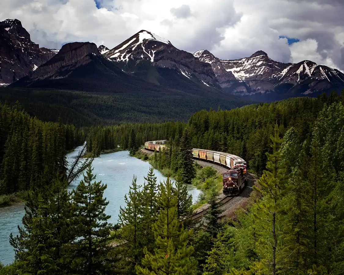
Morant’s Curve is the single most photographed bend of railway track in all of Canada. This quick and easy pullout sits above a sweeping turn where the Canadian Pacific line follows the Bow River. It’s named for Nicholas Morant, the CP photographer who made the shot famous after trekking out here and waiting for days for the perfect shot. The composition does all the work for you: turquoise river, dark spruce, a wall of snow-covered peaks, and a curve of track running through the middle of it.
I’ll be honest, I got very lucky here. On my last drive, I stopped to show the family the view. 5 minutes later, I heard the train horn. Seeing the train at Morant’s Curve is everyone’s big wish, but to do that you actually need a train, and the trains don’t run on a schedule you can look up. Most people show up, stand there for twenty minutes with their fingers crossed, take a photograph of some beautiful mountains, a gorgeous river, and an empty train track, and drive off.
Johnston Canyon
26 km from Banff · 266 km from Jasper · 1.1 km to the Lower Falls, 2.7 km to the Upper Falls · Allow 1 hour for the Lower Falls hike, 2.5 for the Upper Falls hike.
I’ll be straight with you: I stopped here in 2006. In 2026, the parking lot was so crowded that there were no spots available. The family and I made a joint decision to drive on. Sometimes, road trips like this mean making a sacrifice, and this was the one we had to make.
Johnston Canyon is the most popular stop along the Bow Valley Parkway. The canyon, carved into the limestone rock over thousands of years by Johnston Creek, features dramatic cliffs, deep glacial pools, and a series of beautiful waterfalls. It’s also a wonder of engineering, featuring a series of suspended steel catwalks built right into the steep limestone walls, allowing visitors to walk deep into the gorge and directly over the rushing glacial waters below.
Allow an hour for the hike to Lower Falls and closer to two and a half if you continue on to the Upper Falls and the Ink Pots beyond. The catwalks have railings throughout, but they are narrow; they echo, and in peak season you’ll be shuffling along with the crowds. Trail work has closed sections of it periodically, so check Parks Canada’s Banff trail conditions page before building a morning around it.
There are accommodations available at Johnston Canyon Lodge and Bungalows near the trailhead. They book up very quickly, so check the rates and availability before you go.
Lake Louise
58 km from Banff · 232 km from Jasper · Lakeshore is 100 m from the parking area, paved and flat · Allow 1 to 2 hours, plus shuttle time
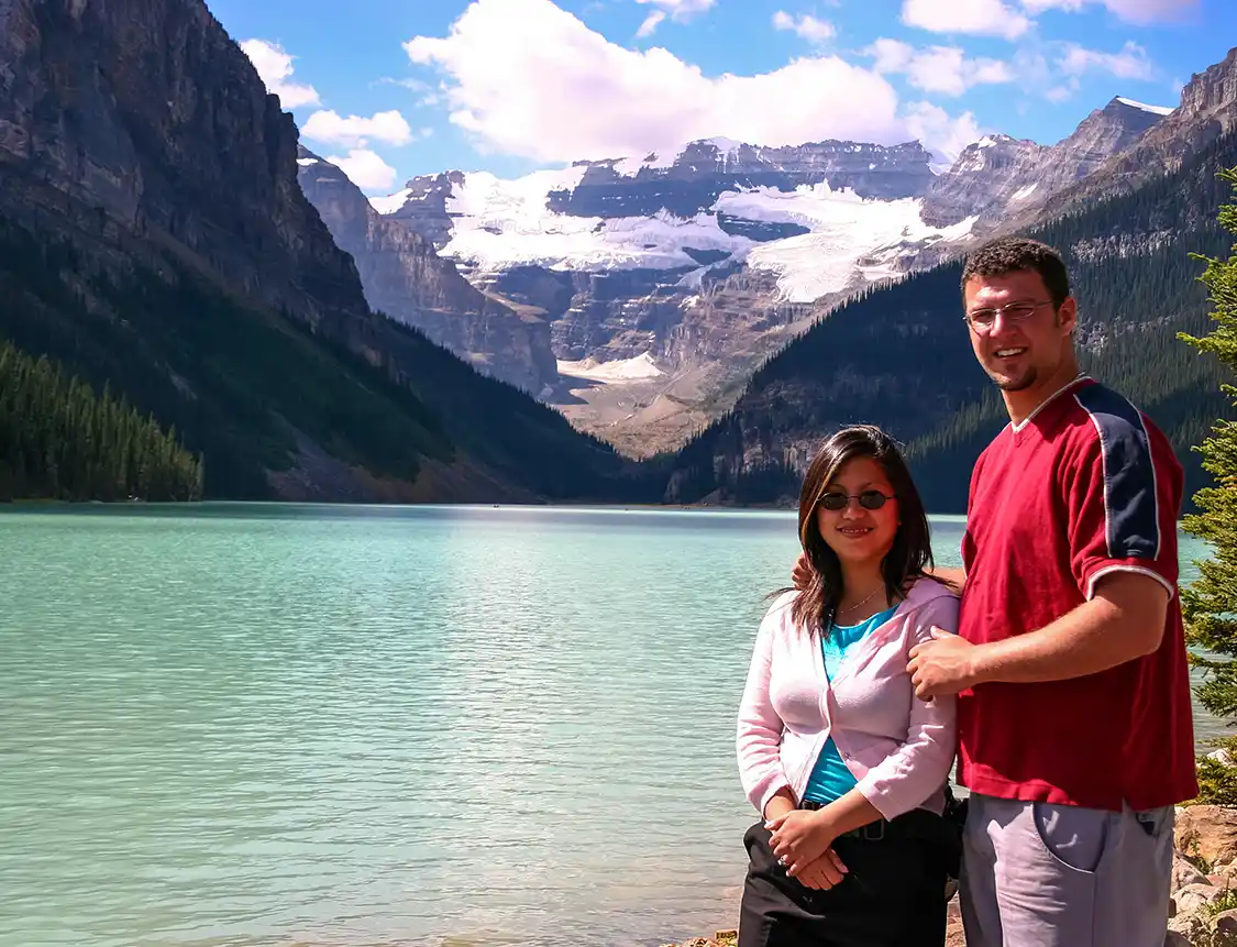
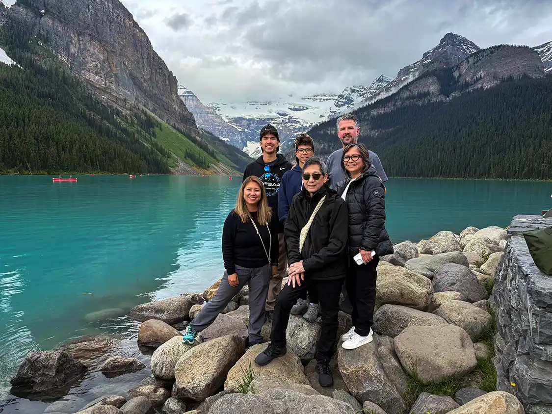
Lake Louise is beautiful. I won’t deny it. A glacial lake the color of antifreeze sitting in a cirque with Victoria Glacier hanging at the far end and a very large hotel at the other. If it’s the first time you’ve seen it in person, you’ll understand immediately why they built the hotel where they did.
But in my opinion, Lake Louise is the most overrated stop on the entire Banff to Jasper drive.
Not because of the lake. Because of what people do when they get there. They park, walk the hundred meters to the shoreline in front of the Fairmont, take the photograph everybody takes, maybe rent one of the iconic red canoes, and leave. An hour, start to finish, most of it within sight of a hotel lobby.
The magic of Lake Louise cannot be appreciated from the front of the Chateau. It has to be walked to. And I’m implicating myself here, because I have two photographs of this lake taken twenty years apart and both were shot from the same patch of shoreline as everybody else’s.
- Lake Agnes Tea House – 3.5 km each way, around 400 m of climbing, two to four hours round trip. A steady forested climb past Mirror Lake into a hanging valley, where a small alpine lake sits with a log teahouse at the end of it that has been there since 1901. The Canadian Pacific Railway built it as a refuge for hikers, and it still runs the way it always did: no road, no power. Then keep going, because the teahouse isn’t the payoff. Push up to the Big Beehive, and you get the view that makes the entire lake make sense. From up there, Lake Louise stops being a backdrop and becomes the icon it should be: a long blue blade of water in a rock bowl, the Chateau shrunk to a doll’s house, and the whole Bow Valley opening out behind it. Nobody who stayed at the bottom knows this view exists.
- Plain of Six Glaciers – 14.2 km round trip, 591 m of climbing, four to six hours. The best hike at Lake Louise and one of the best on this entire drive. The first 3.3 km are almost perfectly flat along the lakeshore, and then it climbs the valley toward the ice. A second teahouse sits near the top, built in 1927, Swiss chalet style, a nod to the Swiss mountain guides the railway imported to keep its guests alive up here. Cash again. What you get at the end is something nobody standing at the hotel will ever experience. You end up close enough to Victoria Glacier to hear it. Ice cracks and shifts and occasionally lets go, and the sound reaches you a beat after the movement, rolling around the cirque. Aberdeen, Lefroy, and Victoria are all visible from the trail. Standing there, with the hotel three hours behind you and a wall of ice above, is what people mean when they say the Rockies are on a different scale.
- Lakeshore Trail – If a six-hour hike isn’t your day, you don’t have to settle for the hotel frontage. The lakeshore trail runs the full length of the lake, level the whole way, paved at first and then wide, flat dirt. The far end is about 2 km out. Most people walk two hundred meters of it. By five hundred, the crowd thins noticeably, and at the back of the lake you’ll be sharing it with a handful of people, looking straight up at the glacier with the Chateau reduced to a smudge behind you. No elevation, no equipment, no fitness required, and it costs nothing. It’s also the first 3.3 km of the Plain of Six Glaciers trail, so you can simply walk until you’ve had enough and turn around.
Parking at the Lake Louise Lakeshore is $42 per vehicle per day in 2026, charged from 3 am to 7 pm between 15 May and 12 October. It was $11.70 in 2021, $21 in 2023, and $36.75 in 2025. Assume another rise for 2027. Parks Canada does not want you to drive to Lake Louise. More to the point, paying is not really an option. Parks Canada states that roughly 75 percent of vehicles attempting to park at the Lake Louise Lakeshore last summer were turned away. RVs and oversized vehicles aren’t permitted at the Lakeshore at all. There is no parking reservation system.
How you actually get there
- Parks Canada shuttle. From the Lake Louise Park and Ride, 1 June to 12 October, every 30 minutes from 6:30 am; last return 7:30 pm. A Lake Connector runs between the Lake Louise Lakeshore and Moraine, and an Alpine Start service leaves at 4 am and 5 am for sunrise. Reservations for 2026 opened on 15 April at 8 am MDT and took nearly 40,000 bookings on the first day. Only 40 percent of seats are released on launch day. The other 60 percent are released at 8 am MDT two days before each departure. That rolling release is the best route for most people, and it is widely misreported. Maximum 10 seats per reservation, which means a family or group of up to ten fits in a single booking if you move fast.
- Roam Transit Super Pass. A day of unlimited Roam travel plus a reserved round trip from Banff to the Lake Louise Lakeshore and on to Moraine. You have to start in Banff; boarding at Lake Louise doesn’t work with this pass. Arrive 20 minutes early with your entire group or the reservation is canceled.
- Commercial operators and bikes. Licensed operators like the one my family used on our 2026 trip are the best workaround. It’s pricier, but offers more availability and flexibility than other options. Licensed operators may use the road, and so may cyclists, at about 12 km each way. Parks Canada explicitly advises against walking it, at 28 km round trip with no cell service, no water, and no lighting.
Where To Stay Along The Bow Valley Parkway
Three lodges sit directly on Highway 1A, and all three are a very different proposition from a hotel in Banff. No lobbies, no elevators, no town. They book out months ahead for summer.
- Johnston Canyon Lodge and Bungalows is the closest to Banff and sits right at the Johnston Canyon trailhead, which means you can walk the catwalks before the day-trippers arrive. The property has forty-two heritage bungalows and cabins with wood-burning fireplaces, full kitchens and private porches, plus a cafe, a bistro serving three meals a day, and a snack shack at the trailhead. Mid-May to October. It books up very quickly, so please check the rates and availability long before you leave for your trip.
- Castle Mountain Chalets sits about halfway along the Bow Valley Parkway at Castle Junction, under that iconic flat-topped wall of rock. The property offers full chalets rather than rooms, with fireplaces, kitchens, and a communal fire pit, and it’s the only one of the three key accommodations along the Bow Valley that are open year-round. This property is handy if you’re switching between 1A and the Trans-Canada. You can check out their current rates and availability here.
- Baker Creek Mountain Resort, more recently known as Baker Creek Basecamp, is the closest accommodation to Lake Louise and the most indulgent of the three places to stay along the Bow Valley Parkway. Log cabins and lodge suites with wood-burning fireplaces and jacuzzi tubs, a steam room and sauna, outdoor fire pits, and in winter, a skating rink and fat bike rentals. You can check out their current rates and availability here.
- Camping: there are three campgrounds along the Bow Valley Parkway. Those are Johnston Canyon campground, Castle Mountain campground, and Protection Mountain campground. Johnston Canyon is the big one and the only Bow Valley Parkway campground with showers. Book early through the Parks Canada website; the July and August slots fill up almost immediately.
Moraine Lake
72 km from Banff · 246 km from Jasper · Lakeshore 100 m, rockpile is a 300 m scramble with steps · Allow 1.5 to 2 hours on site, half a day with the shuttle
Moraine Lake sits at an awkward spot along the Banff to Jasper drive. The lake doesn’t sit along the Bow Valley Parkway, nor does it lie on the Icefields Parkway. Instead, Moraine Lake lies off the HWY 1 and HWY 1A junction about halfway along where it runs parallel to the Bow Valley Parkway. This means making a stop here can be a logistical nightmare. On the bright side, you can’t drive to Moraine Lake anyway, so most people visit here on a combined tour with Lake Louise and Yoho National Park while they’re based in Banff rather than while they’re road tripping from Banff to Jasper.
The Valley of the Ten Peaks, a lake so saturated with blue it looks impossible, and the view that was on the back of Canada’s twenty-dollar bill until 1993. If you see one lake in Banff National Park, this should be it.
In 2006, Christina and I drove up, parked, and had the shoreline largely to ourselves. I sat on a rock near the rockpile, and a pika came out, one of those small, round alpine rodents that Pikachu from the famous Pokémon game is based on. It lived in the boulder fields and sounded a little like a dog’s squeaky toy. It popped out, looked at us, and went about its business.
This summer the boys and I climbed the rockpile, and nothing came out at all. Not one animal. The rockpile isn’t a friendly place for small animals like pikas and marmots anymore. There are simply too many people visiting for them to live a comfortable, quiet life.
Dylan felt the crowds in the same way. A wave of selfie sticks and tripods all gathered near the top of the rockpile. He solved it by walking away from everyone. He climbed down to the water’s edge, sat on a rock with his back to chaos, and just stared out at the lake until we came to find him. For those of you who have followed my family over 15 years of family travel, you’ll recognize that for Dylan to be lulled into silence by a view is a big deal. He’s normally a tornado in a bottle. But Moraine Lake will do that to you.
Before you start packing the car, you need to know that Moraine Lake Road has been closed to personal vehicles year-round since 2023. There is no parking lot to wait for, no early-morning workaround, no off-season exception. It was a traffic decision by Park’s Canada. The lot was filling before dawn, and most people were being turned away.
If you have read anywhere that you should get there early to beat the crowds to a parking space, that advice is three years out of date and will leave you frustrated and unable to see what may just be the most beautiful lake in the world.
The Best Stops Along The Icefields Parkway
After you leave Lake Louise, you’re sitting right at the junction of Highway 1, the Trans Canada Highway, and HWY 93, the Icefields Parkway. If you follow Highway 1, you’ll cross over into British Columbia and wind your way through Golden and Kamloops on your way to Vancouver. But for this road trip, you’ll want to stay right on Highway 93, which takes you toward Jasper.
The Icefields Parkway was commissioned in 1931 as a Great Depression relief project. About 600 unemployed men were put to work cutting a road through one of the least forgiving mountain corridors in all of North America. They were paid five dollars a month, plus a small stipend for tobacco and clothing. Their foremen got sixty. Each camp had a single small tractor, and horses pulled the graders, the plows, and the wagonloads of earth. The road was carved mainly by hand.
It took them nearly ten years. The gravel road opened in 1940, and the paved highway you’ll actually drive wasn’t completed until a realignment finished in 1961. This isn’t a scenic route somebody designed. It’s a make-work scheme that happened to run through the most beautiful place in Canada, built for five dollars a month by men who had no particular reason to believe anybody would ever drive it for pleasure.
Bow Lake
94 km from Banff · 196 km from Jasper · Lakeshore is 50 m from the parking area, flat gravel · Allow 20 to 30 minutes
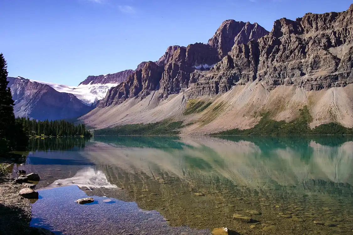
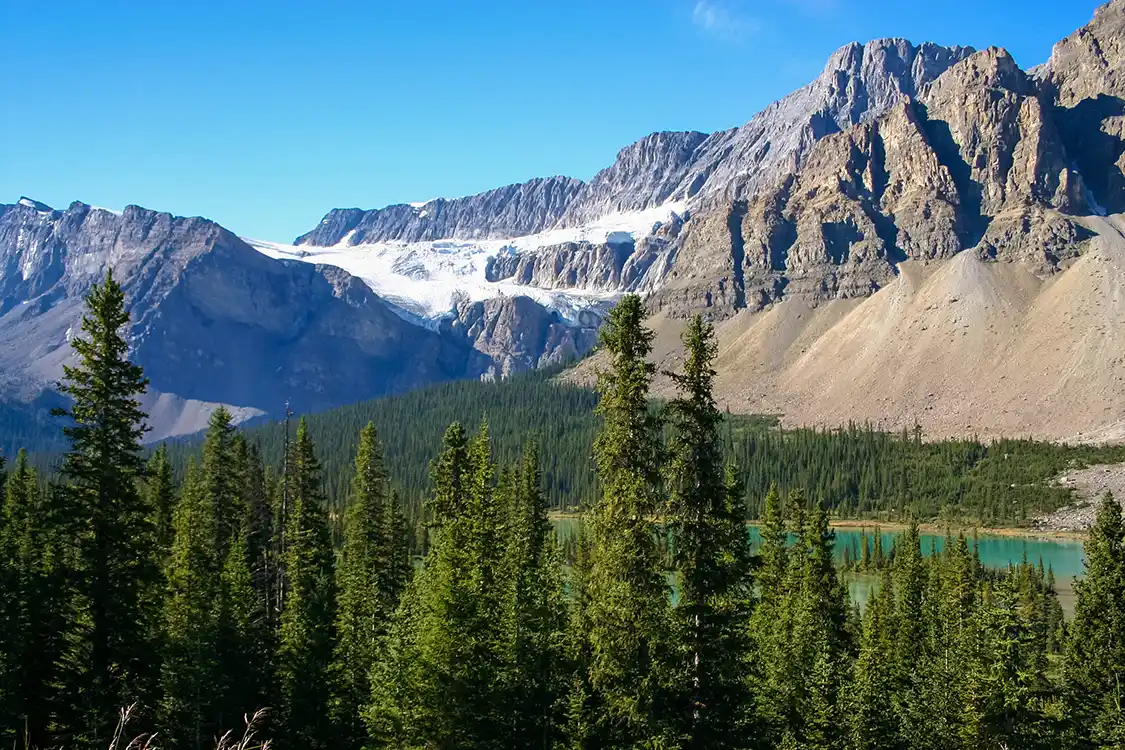
Once you’ve left Lake Louise, the first proper stop on the Icefields Parkway itself, and the one nobody skips, is Bow Lake. This lake sits right beside the highway, with Crowfoot Glacier hanging above it and Bow Glacier feeding it from the back of the valley. The water is a flat, milky turquoise that doesn’t even look natural.
The reason everyone stops at Bow Lake is that it’s pretty and it’s easy. The lake is fifty meters from the parking lot, the ground is flat, and the view smacks you in the face the moment you open your eyes. For a car full of people with different energy levels, that’s worth more than a hike.
There is a popular lodge on the shore that is now called The Lodge at Bow Lake. It operated for decades as Num-Ti-Jah Lodge. This is one of the few non-camping accommodations along the Icefields Parkway.
There’s a popular hike from Bow Lake up to Bow Glacier Falls. In June 2025, a cliff collapsed onto it and killed two people. Parks Canada closed the trail temporarily and reopened it in July 2026 with warning signage in place. The geotechnical assessment concluded that it would be reasonable to expect further rockfalls. If you are traveling with children or older parents, I would avoid taking them up there unless you’re confident in their safety and skills.
Peyto Lake
135 km from Banff · 155 km from Jasper · 500 m uphill from the parking area to the platform, paved and largely accessible · Allow 1 to 1.5 hours
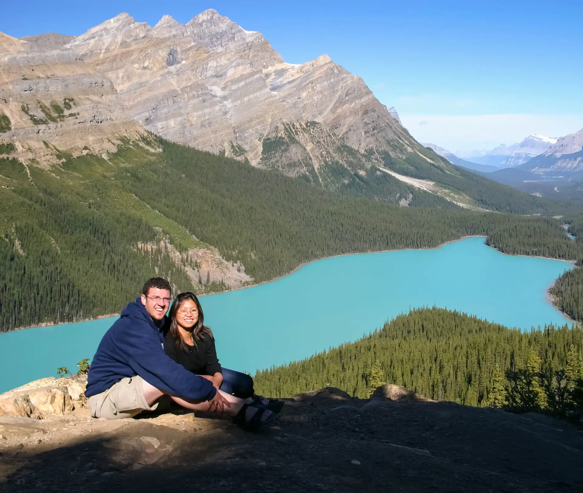
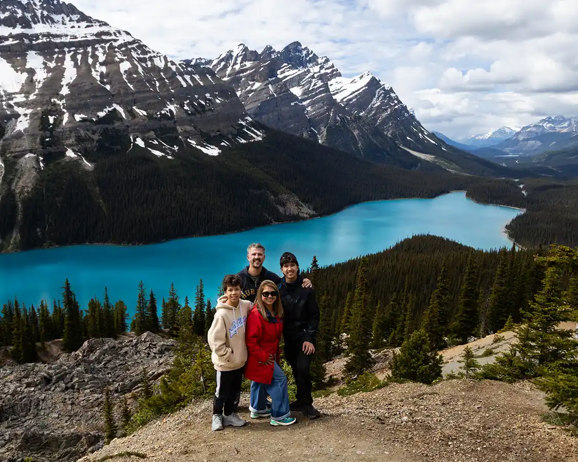
If you only get out of the car once between Lake Louise and the Columbia Icefield, make it here. My father-in-law, who is not in the best health, gave me cursed glares when I insisted he make the steep but graded trail walk to the Peyto Lake viewpoint. He shook my hand when we got to the top and then insisted I take a photo of him with his wife.
The term “impossible blue” gets thrown around a lot in the Canadian Rockies. Peyto Lake puts every single one of those lakes to shame. This Peyto Lake viewpoint sits high above the lake, allowing nature’s magic to amplify the surreal effect that mineral-rich glacier runoff has when reflecting the blue sky. It’s stunning in its position, lying in a valley 250 m below the Peyto Lake viewpoint; it’s jaw-droppingly gorgeous, and the blue hue is so aggressive that those who haven’t seen it firsthand often accuse the photographs of being faked.
The real reason that Peyto Lake, and the other milky blue lakes in the Rockies, appear as they do is due to rock flour. Rock flour is glacial silt ground fine enough to stay suspended in the water, neither sinking to the bottom nor floating to the top.
In 2006, Christina and I were sitting on bare rock at the lip of the viewpoint with our legs out in front of us and nothing between us and the drop. We’d walked up a rough path and found a spot, sharing the moment with maybe two other people. In 2026, we stood at the same point with our two boys. What you can’t see behind the camera is the multimillion-dollar viewing platform and 100 other people all jockeying for the same view. It’s largely accessible and offers great views of the lake. But for the best, climb down beneath it where there are far fewer people.
I want to be fair about this, because the easy move is to be sour, and the easy move is wrong. The new platform is better. It’s safer; it holds the crowds that this place now gets; my father-in-law could walk to it unaided; and the old rough path was quietly eroding the hillside with every pair of boots on it. Rebuilding it was the right call.
If you stop at Peyto Lake (and you definitely should), know that the lot fills by mid-morning through the summer, and there is nowhere else to leave a car. Allow 60 to 90 minutes if you want the walk up and time at the top. At 2,068 m, this is the highest point on the drive, and anyone who isn’t used to hiking at altitude will notice it here.
Mistaya Canyon
158 km from Banff · 132 km from Jasper · 500 m downhill from the road, then back up · Allow 45 minutes
A short, steep walk down from a roadside pullout will take you to a slot canyon where the Mistaya River has drilled through limestone into something that looks less carved than melted. Potholes, curves, a footbridge over the gap, and water moving fast enough that you feel the shake through the rock.
The catch is the walk back. It’s only half a kilometer, but it’s uphill the whole way, and it’s the first stop on this drive that will genuinely sort your group by fitness level. The hike is worth it if everyone’s up for a little sweat. It’s also easy to skip if they’re not.
Saskatchewan River Crossing
166 km from Banff · 124 km from Jasper · Roadside, plus a viewpoint a short walk from the lot · Allow 20 minutes, or 45 with fuel and food
Saskatchewan River Crossing is the end-all and be-all of service stops between Banff and Jasper. It’s the only service station on the entire Icefields Parkway, at the junction where Highway 11 comes in from the east. Gas, a restaurant, rooms, and the only flushing toilets between Lake Louise and the Icefield Center.
We stopped for the view, which is genuinely good: the North Saskatchewan River braiding out across a wide gravel floodplain with Mount Wilson standing over it. The Crossing has a reputation for monopolistic pricing (when you’re the only fuel in 232 kilometers, you don’t need to be competitive, and they aren’t).
Treat this place as insurance, not as a plan. It’s seasonal, open roughly April or May to October, and it shuts for the winter entirely. Hours are not reliably published anywhere I could find, so if you’re arriving late in the day or late in the season, call ahead and have a fallback. Fill up in Lake Louise.
There are accommodations available at Saskatchewan River Crossing. It’s nothing fancy, but it’s good in a pinch if you find that you got caught up in too many morning hikes and the day has gotten away from you. The Crossing Resort at Saskatchewan River Crossing is the name, and like everything on the Icefields Parkway, it books up quickly.
Bridal Veil Falls Viewpoint and the Big Bend
173 km from Banff · 115 km from Jasper · Roadside pullout, no walk · Allow 15 to 20 minutes
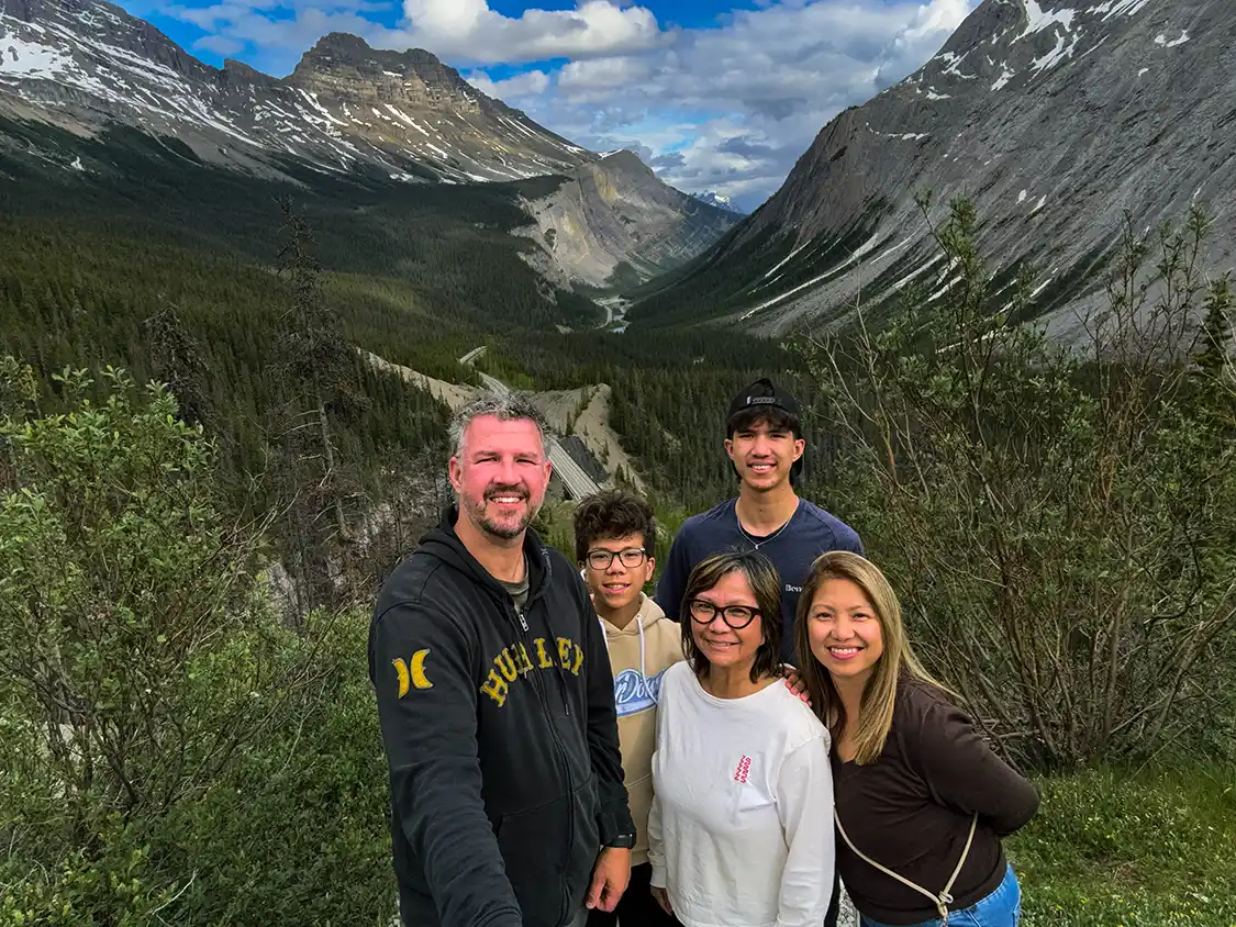
This is the hardest piece of driving on the entire Banff to Jasper route. The Icefields Parkway leaves the North Saskatchewan River valley and climbs the Big Hill in a single sustained haul toward Sunwapta Pass, swinging through an enormous switchback known as the Big Bend on the way up. In a loaded vehicle, you’ll feel the engine working, and you’ll want to be in a lower gear coming back down.
The pullout near the top looks across at Bridal Veil Falls, a long white ribbon dropping down the far wall of the valley. But the falls aren’t the reason to stop. Turn around. From up here, you look back down the whole valley you just climbed out of, with Highway 93 threading along the North Saskatchewan River far below, running between the mountains until it disappears. You can see exactly where you’ve been and how far you’ve come, which is a thing this road almost never gives you. Most people photograph the waterfall and miss it entirely.
Panther Falls is at the same pullout; it can be reached by a short, steep path, and it’s taller than Bridal Veil.
About 8 km before you get to the Big Bend, pay attention to the right-hand side of your window. The Weeping Wall is a broad cliff face streaked with meltwater that freezes into a famous ice-climbing wall in winter. If you passed it without stopping, that’s what it was.
The Columbia Icefield and the Athabasca Glacier
184 km from Banff · 106 km from Jasper · Glacier Discovery Centre is roadside; glacier access is by tour only · Allow 45 minutes for the view, 3 to 3.5 hours for the glacier tour
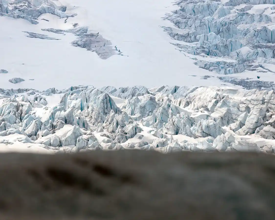
The Columbia Icefield is the largest icefield in the Rocky Mountains. This massive wall of frozen water sits up on the Continental Divide, and it sends meltwater to three different oceans. The Athabasca Glacier is the tongue of the entire frozen system that comes down almost to the road, and this is the only place in North America where you can drive to within sight of that much ice and then get out of your car and walk on it.
The Columbia Icefields and the Athabasca Glacier are the main reason most people drive this road, and it’s the stop I have the most complicated feelings about.
When I first visited in 2006, Christina and I drove right up to the glacier. We got out and walked around on the ice. The slushy melt soaked through our shoes. The fact that you can’t do that now without joining a tour is a good thing. We walked down toward the river that runs out of the glacier’s snout, and climbed around on the rocks at the water’s edge, taking photographs. There wasn’t much telling us where to go. You walked until the ground got too difficult to manage and then you stopped, and the whole thing felt like something you’d found rather than something you’d bought a ticket for.
The Columbia Icefield Adventure runs from the Glacier Discovery Centre and takes two and a half to three hours. You board an Ice Explorer, a six-wheeled all-terrain monster bus built for transporting big groups across a landscape that no Honda Civic could ever reach. The tour drives out onto the surface of the glacier, where you get roughly half an hour to stand on it, take some photos, and then get back on the bus. That same ticket includes the Glacier Skywalk, a glass-floored platform cantilevered 280 m above the Sunwapta Valley, which you reach by shuttle because you cannot drive or walk in.
Two things are new. There’s now an Ice Odyssey, a small-group tour capped at ten people in an all-terrain vehicle that goes to a site the big buses don’t reach, with a glaciologist’s commentary and the chance to use some mountaineering gear. It requires climbing a ladder to board and has a minimum age of six. And in May 2026, Pursuit, the company that runs it all, launched the world’s first electric Ice Explorer, with solar panels, regenerative braking, and a frame more than half the weight of the old ones. It’s one vehicle on seasonal rotation rather than the whole fleet, so don’t promise your kids they’ll ride it.
The Columbia Icefields tours run from May 1 to October 11, weather permitting, and 2027 dates are already booking.
You are allowed to walk to the toe of the glacier. But you are not allowed to walk out onto the glacier on your own. From a distance, glaciers and icefields look like pure ice, solid and unmoving. Get up close, and you quickly realize that they are a minefield of soft ice, canyons, and crevasses, some more than 100 meters deep. People have died falling into crevasses hidden under snow bridges.
This summer there are large, well-made viewpoints. There’s a new exhibit at the Icefield Centre, opened in May 2026, called Meltdown. The product is organized, interpreted, and considerably safer, and the information is better than anything we had in 2006.
It’s still beautiful. It is not, any longer, a place you ‘discover.’ That intimacy is gone, and it isn’t coming back, and I notice I’m the sort of person who both misses it and recognizes that I’m part of the reason it went down the way it did.
The Athabasca Glacier has been receding for the last 125 years. In 2023, it lost more ice to melt than in any of the previous ten years. And 2025 was the second-worst year on record for glacier loss across Western Canada, with researchers at the University of Northern British Columbia estimating roughly 30 gigatonnes of ice lost regionally in that year alone. Wildfire smoke is making it worse, because soot darkens the ice and darker ice absorbs more heat.
Pursuit provided our family with a Pursuit Pass covering the Banff Gondola, an open-top tour in Banff, and the Columbia Icefield tour. They had no input into this article and did not see it before publication. The paragraphs above are my experiences.
Tangle Creek Falls
191 km from Banff · 97 km from Jasper · Falls are right at the roadside · Allow 20 minutes, or 40 with the climb
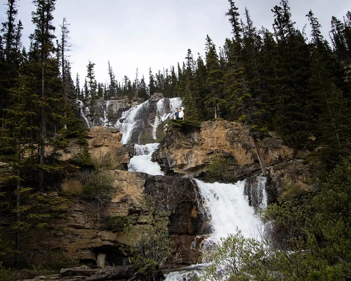
Seven kilometers past the Columbia Icefield Discovery Centre, a 35-meter multi-tiered waterfall comes down the rock face directly beside the highway. There is no trailhead, and no approach signage. You park across the highway and cross the road. There’s no crosswalk, so pay careful attention.
That accessibility makes it one of the busiest pullouts on the Icefields Parkway, but almost nobody stays more than five minutes, so the crowd turns over constantly and you rarely wait.
The reason to stay longer is the trail. A short, steep path climbs the side of the falls and takes about fifteen or twenty minutes, and it puts you level with the upper tiers rather than looking up at them. Our boys went straight up it and came back soaked, because on a warm day the spray comes off the rock in sheets and drifts a long way out over the path. There was no persuading them to stay dry and no point trying.
Sunwapta Falls
233 km from Banff · 57 km from Jasper · 200 m from the parking area to the upper falls, paved · Allow 30 minutes, or 1.5 hours including the lower falls
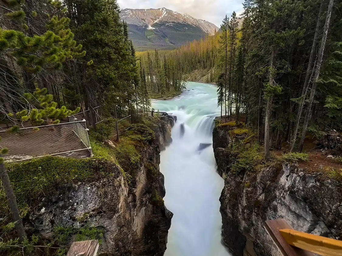
The Sunwapta River drops into a narrow limestone gorge around a small forested island, and the upper falls are a two-minute walk from the car along a manmade path. This is one of the easiest big payoff viewpoints on the drive. There’s a footbridge over the top of the gorge that puts you directly above the drop.
A longer trail of about 1.3 km continues down to the lower falls, which are broader, quieter, and almost empty, because the overwhelming majority of people photograph the upper falls and get back in the car. If your group splits by energy, this is a good place to do it: one half waits on the bridge, the other half walks down.
On my latest drive with my extended family, this is where we stopped for the night. Breaking up our Banff to Jasper road trip into two separate days. We stayed at Sunwapta Falls Rocky Mountain Lodge, which is a quiet, lodge-style accommodation with simple rooms that haven’t changed much since the 1970s. It’s easy, comfortable, and relatively no-frills. There are BBQs on site, but the restaurant serves up some decent meals for a pretty good price. The breakfast is better than it needs to be. Their bowls are the kind of fuel you need for another big day mixing sightseeing and hiking.
Goats and Glaciers Lookout
250 km from Banff · 38 km from Jasper · Roadside pullout, no walk · 10 to 15 minutes if there are goats
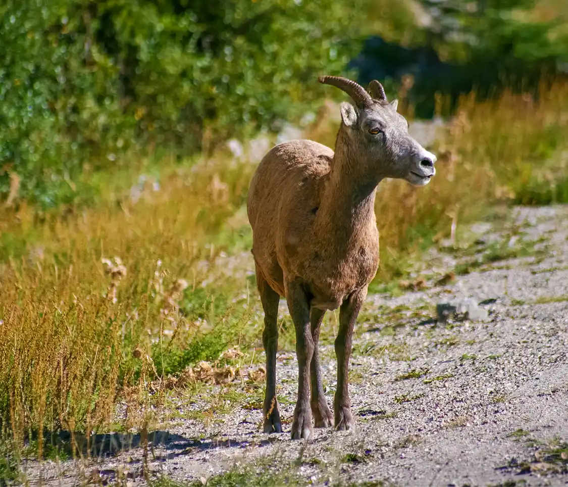
Goats and Glaciers is a pullout above the Athabasca River that most people drive straight past. If you stop, and you’re a little lucky, then you might be rewarded with something special. The name is pretty indicative of what you have a chance of seeing here. There’s a natural mineral lick on the river flats below, and mountain goats often come down off the cliffs to get at it.
Goats need sodium and other minerals they can’t get from alpine vegetation, so they’ll descend a long way to reach deposits like this one. Spring is the best time for it. In summer, they’re mostly up in the high meadows.
We didn’t see any on our last pass. When the goats are there, they’re usually across the river or partway up a slope rather than posing at the railing, so bring binoculars and give it ten minutes rather than thirty seconds. I’ve written much more about where and when to find animals along this road in my guide to wildlife in the Canadian Rockies, including how to tell a goat from a sheep at a distance, which is less obvious than it sounds.
Athabasca Falls
256 km from Banff · 34 km from Jasper · 150 m from parking, paved walkways and viewing platforms · Allow 30 minutes
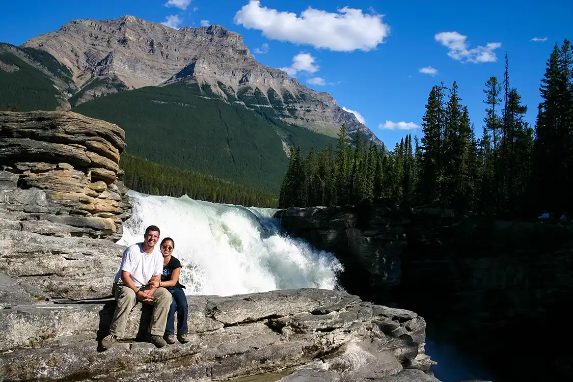
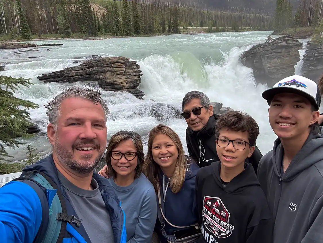
Athabasca Falls is not the tallest waterfall in the Rockies, not even close, but it is the most powerful thing you’ll stand next to on this drive. The Athabasca River funnels its entire volume through a narrow gap in hard quartzite rock that is maybe a few meters wide, and the result is less a waterfall than a jet stream. You feel it in the overhead walkway. On a June afternoon with the snowmelt running, the noise flattens conversation, and the spray reaches you well back from the railing.
Follow the trail to the far side, and you’ll find an overlook near the top of the falls that’s perfect for a shower. The back spray from the powerful waterfall will soak you through even if you’re wearing a raincoat. That same trail winds down between the rocks to the lower end of the falls, and it’s worth making the walk. Not for the falls, but for another reason altogether.
Gaze across from where Athabasca Falls dumps back out into the Athabasca River, and you’ll see an endless field of destruction.
The 2024 Jasper Wildfire Complex burned through roughly 33,000 hectares of the Athabasca Valley between July and September that year. That’s about three percent of a Canadian National Park covering 1.1 million hectares. As it burned, it tore through the part where everybody lives and drives. On the evening of 24 July, the fire reached the Jasper townsite itself and took 358 of its 1,113 buildings with it, about a third of the entire town of Jasper, in a single night. A 24-year-old wildland firefighter named Morgan Kitchen was killed by a falling tree a few weeks later.
What you’re looking at from this trail is what a fire that size leaves behind. Standing trunks with nothing on them, bark gone grey and silver, the whole valley opened up so that you can see the shape of the land underneath in a way nobody could before.
Within a few months, there was green under those dead trees. Hairy wild rye first, then clasping aster, then fireweed putting purple through the whole burn, then goldenrod and arnica and black-eyed Susan. Elk and deer were back inside a couple of months, grazing on growth that didn’t exist before the fire cleared the canopy and let the light in. If you’ve wondered why wildlife sightings around Jasper have been so good lately, that’s why. The burn is a buffet.
As horrible as the fire was, that is how this forest is supposed to work. Lodgepole pines make serotinous cones, sealed shut with resin, which only open in the heat of a fire. The tree spends its life waiting for the thing that kills it, and then seeds the bare ground it leaves behind. Fire doesn’t end a lodgepole forest. Fire is how it reproduces.
In the places where this fire burned hottest, nothing survived at all. Not the trees, not the seedbank in the soil, not even the serotinous cones that exist for exactly this purpose. Tracy McKay, who leads Parks Canada’s ecologist team, has said plainly that some of these forests will never be forests again, because there’s nothing left to regrow from. Researchers tracking the Rockies are seeing wholesale shifts in which species mark a return, and Jasper looks likely to be another case of it.
So what you’re standing in front of is not a tidy story about nature healing itself. Some of it will be lodgepole again in five years. Some of it will be meadow and shrub for a very long time. Parks Canada is planting tens of thousands of whitebark pine seedlings bred to resist blister rust, so they’re not simply waiting to see what happens.
Stand there for a few minutes before you walk back up to the top of the roaring falls. It’s the most interesting ten minutes on this entire drive, and almost everyone who stops at Athabasca Falls photographs the water and leaves without ever turning around to take in that view.
Horseshoe Lake
263 km from Banff · 25 km from Jasper · 300 m from the parking area to the shore · Allow 45 minutes to an hour, longer if anyone swims
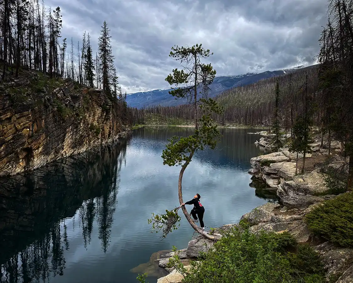
This is my favorite stop on the entire drive, and the one almost nobody visits.
Horseshoe Lake is a deep, clear, horseshoe-shaped lake ringed by low cliffs, a few minutes off the Icefields Parkway along a short trail through trees. There’s no visitor center, no interpretive panel, no gift shop, and no bus parking. The highway signs for it aren’t even posted anymore. You pull into a small lot, walk three hundred meters, and arrive at the most peaceful place on this side of Jasper.
After three days of staring at famous turquoise lakes from designated viewpoints, the freedom of Horseshoe Lake is hard to overstate. Unless you’re willing to embark on some of the many incredible backcountry hikes along the Icefields Parkway, this is the closest thing left on this road to what the whole road used to feel like. We climbed over rocks, the boys climbed trees, and nobody told us where to stand. The water is so clear you can see the rock shelving beneath the surface, and the loudest thing there was us.
It’s known locally for cliff jumping, with the highest point somewhere around 80 feet, and people do scuba diving and swim here. Nobody in our party went in; we hadn’t even packed our swimsuits. It was early in the season, and that water was cold enough to make the decision for us, which saved me from having to be the parent who says no to a fifteen-year-old standing at the top of a cliff.
If you do swim, understand what you’re choosing. The cliffs are high, the water is cold year-round, and cold water takes the strength out of you fast, and there are no facilities and no lifeguards. Having somebody spotting you is the minimum. This can be dangerous if you’re not careful. The realistic window for swimming at all is July and August.
Parking is limited to a small area with no facilities of any kind, including toilets. It fills up on hot summer afternoons. Go early, or go in the evening, which is when we had it almost to ourselves.
Mount Edith Cavell – Currently Closed
I have to write this one in the past tense, and I’m not happy about it.
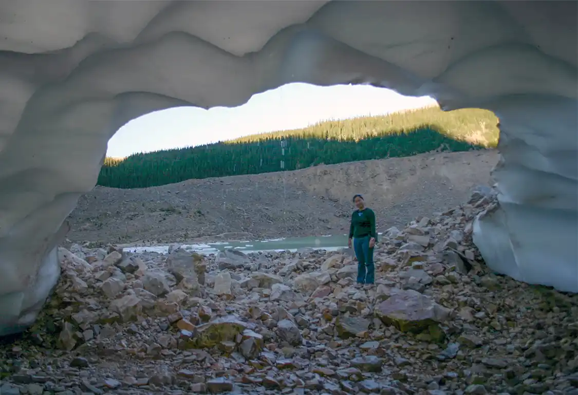
Mount Edith Cavell was my favorite stop on my 2006 trip. Christina and I drove up a tight, twisting road to a cirque beneath a 3,363 m north face, and at the bottom of it sits Angel Glacier, hanging off the mountain with its wings spread, feeding a small pond full of icebergs. The path from the car park goes up through boulder fields onto moraine, and you stand there in the cold air coming off the ice, listening to the mountain drop pieces of itself into the water. Across the lake is a natural ice cave formed by runoff from the Edith Cavell Glacier.
Cavell Road, the Cavell Meadows trailhead, and the whole area are closed until further notice following the 2024 fire. Geotechnical work is complete, and repairs are underway, but there is no reopening date. It’s closed to bikes as well as cars. A separate caribou conservation closure runs 1 November to 15 May every year regardless. If you’ve seen the Cavell Meadows hike on a list of things to do in Jasper, that list hasn’t been looked at since the fire.
Where To Stay Along The Icefields Parkway
- The Lodge at Bow Lake – Lying 36 km north of Lake Louise, right on the Bow Lake waterfront. The property was formerly known as Num-Ti-Jah, but was recently redeveloped. This is the only place you can watch that milky turquoise water change color through the evening without anybody else in the frame. The lodge is open from May to October. You can check their current rates and availability here.
- The Crossing Resort at Saskatchewan River Crossing is located 80 km into the Icefields Parkway. It’s the exact midpoint of this section of the Banff to Jasper drive, and offers the only complete services on the road. Rooms, a restaurant, and the only fuel stop after Lake Louise. It is not a destination, per se; it is a strategically placed rest stop. For exhausted travelers, that can be even more important. The Crossing at Saskatchewan River Crossing is only open during the summer, so plan your trip accordingly in the off-season. You can check their current rates and availability here.
- Glacier View Lodge, located right at the Columbia Icefield, 126 km in, is the biggest splurge west of Lake Louise. The elegant rooms here directly face the Athabasca Glacier, which means you can watch the ice go pink at sunset after the last Ice Explorer has gone home and the car park has emptied. The Glacier View Lodge is seasonal, only operating during the Summer months, and it books up well in advance. You can check their current rates and availability here.
- Sunwapta Falls Rocky Mountain Lodge sits 53 km south of Jasper. This is where we broke the drive. Sunwapta is a quiet, lodge-style accommodation with simple rooms that haven’t changed much since the 1970s. Barbecues are available on site, and there is a restaurant serving decent food at a fair price. The breakfast is better than it needs to be. The lodge is open from mid-May to mid-October and closed in the off-season. You can check out their current rates and availability here.
- Hostels. Hostelling International runs a chain of small wilderness hostels along the Icefields Parkway. These include Mosquito Creek, Rampart Creek, Hilda Creek, Beauty Creek and Athabasca Falls. They are all rustic in the genuine sense. Several do not have running water, but they offer, by far, the cheapest beds on the Banff to Jasper drive. Mosquito Creek and Rampart Creek stay open year-round.
- Camping – There are nine campgrounds strung along the Parkway, and almost all of them are first come, first served. If you want to camp there, you need to arrive early. Like, before most people are checking out, kind of early. Rampart Creek is the only Banff-side one you can reserve. On the Banff side: Mosquito Creek (24 km, 32 sites), Silverhorn Creek (56 km, 45 sites), Waterfowl Lakes (60 km, 116 sites) and Rampart Creek (90 km, 51 sites). On the Jasper side, measured south from Jasper: Wilcox Creek (107 km), Icefield (106 km, tents only), Jonas Creek (78 km), Honeymoon Lake (52 km) and Mount Kerkeslin (36 km). The campsites are all basic. Dry toilets, cooking shelters, bear lockers, no power, and no flush toilets anywhere. Arrive in the morning in July or August, or you won’t get a site.
Arriving In Jasper
Pulling in to Jasper now is not the same experience today as it was 20 years ago.
On 22 July 2024, an evacuation order went out for Jasper National Park and the townsite, and around 25,000 people left on a single highway. Two days later, on the evening of the 24th, fire reached the town. It destroyed 358 of 1,113 structures, roughly a third of everything in it. The west end, around Patricia Street, Geikie Street and Cabin Creek Drive, took the worst of it, and one neighborhood there was almost entirely lost. The hospital, the school, the water treatment plant and the emergency services all survived.
Jasper is in the middle of rebuilding itself. It’s got some work to do, but it’s starting to look more like a finished product every day. As of October 2026, debris removal is complete across every affected property, 73 of 374 destroyed properties are rebuilt and occupied, and 98 more are under construction. Expect active construction on many blocks, especially in the west end, and expect it to look better than you feared.
About 97 percent of Jasper National Park was untouched by the fire. The drive in is largely as it always was, and then there are stretches of standing dead trees and the green sprouting beneath them.
Visitation to the city is down since the fire. Nearly 400,000 fewer people in 2025 than there were in 2021. But Jasper is open for business. There are more than 25 accommodations, 70 restaurants, and 50 experiences operating now. So my ask for you is simple: come to Jasper, and spend money while you’re here. Eat in the restaurants. Buy a couple of souvenirs from the shops. This is one of the few places where being a tourist in Canada actually helps to solve a problem.
The Best Things To Do Around Jasper
Lake Edith
5 km from Jasper townsite · Lakeshore is right at the parking area · Allow 1 to 2 hours, more if the beach is warm
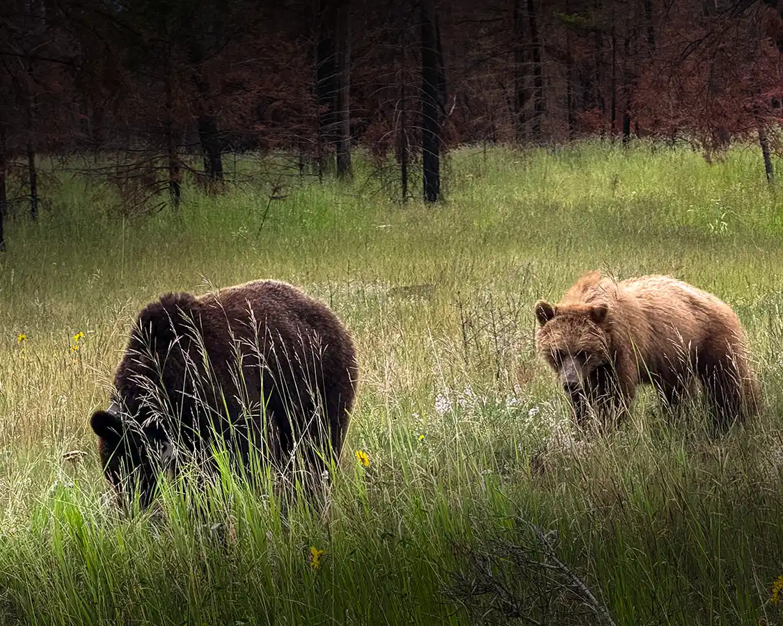
Lake Edith and its neighbor Lake Annette both reopened in 2024 after the fire. They’re shallow, which by Rocky Mountain standards means they warm up enough in late summer that a person can actually get in without swearing under their breath. There are narrow beaches, washrooms and easy flat shoreline paths, and after a week of looking at magnificent cold water from behind railings, being allowed to just sit on a beach is worth more than it sounds.
This is also where we had the coolest wildlife encounter of the entire Banff to Jasper road trip.
Two grizzlies came out into the meadow near the road. Young ones, both of them, and by the look of them, brothers traveling together after leaving their mother. They grazed through the long grass, and then they had a short, shoving, entirely unserious tussle with each other maybe a few feet from the vehicle, the way two teenagers like Cohen and Dylan do when they’ve got energy and no way to burn it off.
The forest behind those bears is burnt. Rust-red dead needles, blackened trunks, the whole stand killed in 2024. The meadow they’re feeding in, thick with grass and yellow and white wildflowers, is what came up underneath after the canopy burned.
Parks Canada has been reporting more sightings of large animals in the fire-affected parts of Jasper, because open regenerating ground is both better feeding and easier to see across than dense forest was. Those two bears were in that meadow because of the fire.
Pyramid Lake and Patricia Lake
7 and 5 km from Jasper townsite · Both have shoreline within a short walk of parking · Allow 1 to 2 hours for the pair, ideal for an evening
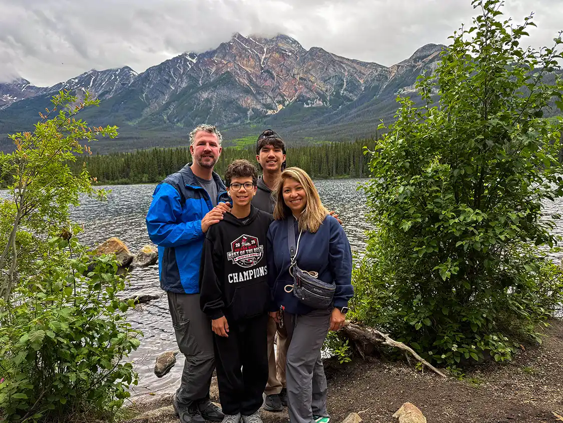
Two lakes in the hills just above the town, close enough to do in an evening. Pyramid has a small island reached by a wooden bridge that is the most photographed place in all of Jasper after the mountain behind it, plus a beach, riding stables, and trails along the bench above. Patricia is quieter, with cabins around it, and is one of the few lakes up here warm enough that swimming is a real proposition rather than a dare.
Pyramid Road is open year-round. Pyramid Beach Road is seasonal, 1 May to 26 October, and there’s a 7.5 m vehicle length limit, so leave the big rig at the hotel.
The Maligne Valley
Medicine Lake 20 km · Maligne Lake 48 km from Jasper, on Maligne Lake Road · Allow 15 minutes at Medicine Lake, and most of a day for the valley with the Spirit Island cruise
Accessing the Maligne Valley means taking a side road running southeast from town. It’s the biggest detour in this guide. Give it most of a day. Maligne Lake Road reopened in October 2024 after the fire and is fully open now, though the Moberly Bridge on the way carries weight limits and only takes one bus at a time.
This route is a popular wildlife viewing spot for bald eagles and marmots, who often fill the valley floor at the north end of Medicine Lake.
Maligne Lake and Spirit Island
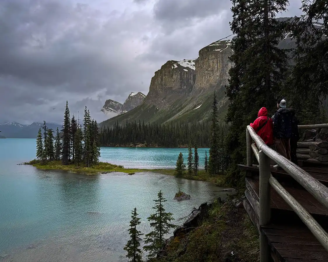
The biggest lake in Jasper National Park and the source of the most reproduced photograph in the Canadian Rockies. Spirit Island isn’t an island most of the year; it’s a tombolo attached by a thin gravel spit, and you can’t drive or hike to it. The only way is the boat cruise, about an hour and a half round trip, running from 28 May to 10 October in 2027.
A seasonal shuttle runs from the town if you’d rather not drive the valley road twice. There are a couple of restaurants, a gift shop, and flush toilets at the business end of Maligne Lake, but once you get on the cruise, you won’t have access to any more services.
Now, I want to share a personal opinion about Spirit Island that I’ve never seen mentioned anywhere else. When I have visited this special place, and it is very special, everyone I’ve seen has been so caught up with the island that they fail to take in the full breadth of what makes it so special. Take a moment and step back. Take in the background, the lake, the towering green cliffs where snow still clings to the shaded areas. Spirit Island is beautiful, but everything that surrounds it makes the place truly astounding.
Even low clouds and dreary rain couldn’t take the magic away when I visited with the whole family. Those low clouds came down over the peaks and sat halfway up them; the light went flat and silver, and the water turned a deeper, colder turquoise than any photograph of this place had led me to expect. There were maybe six of us on the viewing platform instead of sixty. Rain on the lake, rain on the boardwalk, nobody talking much. The famous version of Spirit Island is a bluebird day with a line of people waiting for the same shot. What we got was a gray lake, a small island of spruce, and the distinct sense of having been let in somewhere.
If the forecast is bad on the day you have the boat booked, go. The cruise runs in rain. You will have the platform largely to yourself, and I suspect you will come back with a better photograph than the people who waited for sun.
Maligne Canyon – Currently Closed
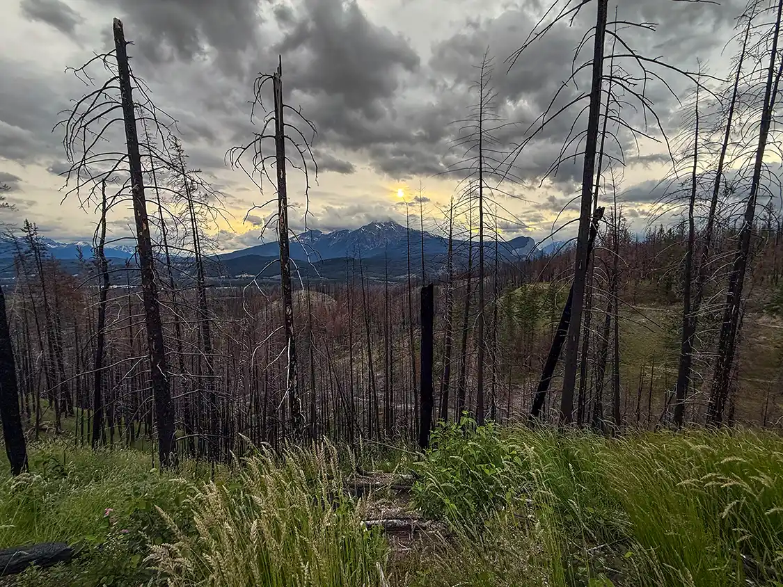
Maligne Canyon is Jasper’s most famous short walk, a limestone slot up to 50 m deep crossed by a series of bridges, and the venue for the winter ice walks that are a signature Jasper experience.
It is closed year-round for all activities: no hiking, no ice walks, no ice climbing. Trail re-establishment is only in the early planning stages, and no reopening date exists. Parks Canada has said the most significant wildfire impacts in areas like this one are not always visible at the surface, which is a careful way of saying the ground itself is the problem. If it’s on an itinerary you’ve been handed, that itinerary predates the fire. Driving back down the valley from Spirit Island, this was the stop we wanted and couldn’t have.
Similar to Athabasca Falls, the pull-off near the entrance to Maligne Canyon is one of the best places in Jasper to get out of the car and take in the full scope of the 2024 Jasper wildfires. It’s not rare to see elk wandering through the trees or along the roadsides here, and it’s very easy to see them because there are very few trees blocking the view anymore.
Other Jasper Stops Worth Visiting
Miette Hot Springs
61 km from Jasper townsite, east on Highway 16 then up Miette Road · Allow half a day: an hour each way, plus 1.5 to 2 hours in the water
The hottest mineral springs in the Canadian Rockies, cooled from a scorching 54°C down to about 40°C before they let anybody in, sit at the end of a winding mountain road with the Fiddle Valley dropping away below. After days of driving and walking, lowering yourself into that water while looking at those peaks is the best thing that will happen to your legs all trip.
It reopened after the fire in 2024 and runs a normal season, roughly mid-May to mid-October. Miette Road itself is open 15 May to 12 October. There’s no food or retail on site, so eat first.
The access road still hasn’t been repaired after a 2023 mudslide, so driving out ot the hot springs can be a bit of a rough ride. One section runs single-lane alternating under automated traffic lights, and Parks Canada is only at conceptual planning for reconstruction with no timeline at all. Maximum vehicle length is 7.5 m, and no trailers or large motorhomes are allowed past the Miette campground.
Cold Sulfur Spring
On Highway 16 east of Jasper, near Disaster Point · Roadside, no walk · Allow 15 minutes
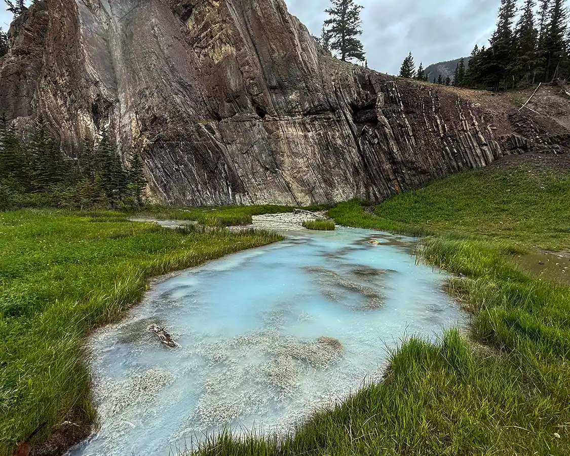
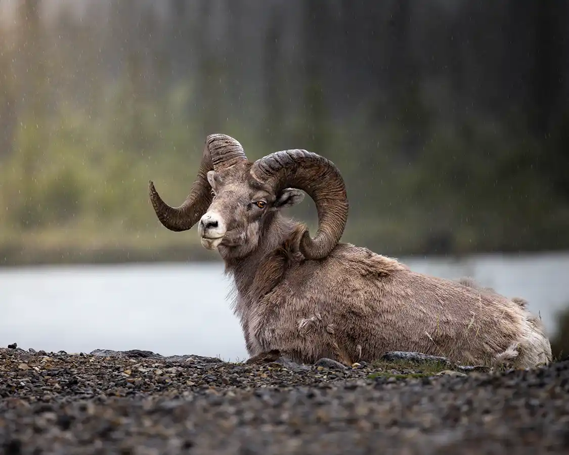
A small roadside spring that most people drive straight past, and the most reliable wildlife stop in Jasper National Park. The mineral content draws bighorn sheep down out of the hills to the road edge, the same mechanism as Goats and Glaciers Lookout, except that here it works almost every time.
We pulled in, and there was a full-curl ram lying in the grass at the edge of the parking area, a few car lengths from the Athabasca River, entirely unbothered by any of us. Not on a cliff. Not a white speck through binoculars. Lying down, close enough to see the growth rings on his horns, looking like something off a coin.
He was the single most impressive animal of the trip, and we found him in a gravel pullout next to a highway, which is the Canadian Rockies in miniature: you spend a week looking for wildlife in the right places, and then the best of it turns up where you stopped for no reason.
Telling them apart, because this trips up almost everybody, including me. Bighorn sheep are brown with heavy curled horns and a pale rump. Mountain goats are white with short black horns and a beard. If it has the big curl, it’s a sheep. There is more on this, and on where each one shows up along this road, in the wildlife guide linked above. Pair this with a Miette Hot Springs run rather than driving out separately, since they’re on the same road.
Valley of the Five Lakes
9 km south of Jasper on the Icefields Parkway · 4.5 km loop, 66 m of climbing · Allow 1.5 to 2 hours
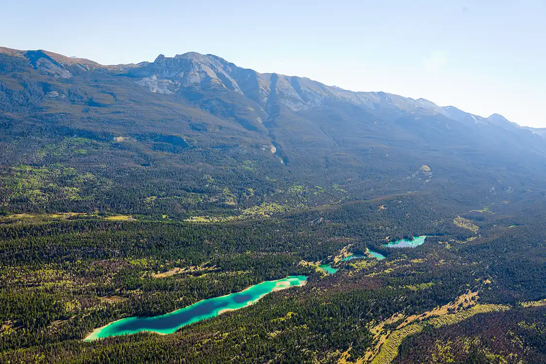
Five small lakes strung along a valley floor, and the reason to walk it is that they’re all different colors. Not subtly. You come over a rise from one lake to the next and the water has changed from pale jade to deep blue, and then changed again. It’s glacial rock flour in the water, plus algae and differing depths, which is the sort of explanation that doesn’t reduce the effect at all when you’re standing there looking at it.
The third and fourth lakes are the ones people stop at. The loop is easy but not paved, with boulder sections and uneven footing that get slippery after rain, so it’s trail shoes rather than sandals.
It’s bear country and seriously so, especially spring and late summer when the berry crop comes in. Make noise, carry spray, and read the trailhead board.
Reopened for summer 2026 after being closed following the fire, and with Maligne Canyon shut indefinitely, this is now the best short walk near Jasper.
Jasper SkyTram
7 km from Jasper townsite · Seven minutes up · Allow 2 to 3 hours
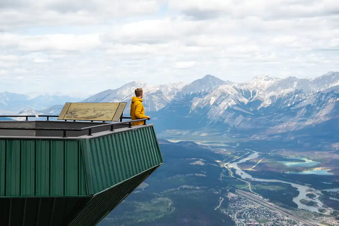
Seven minutes in a cable car takes you from montane forest to alpine tundra at 2,263 m, which is a transition that would otherwise cost you most of a day on foot. It bills itself as the highest and longest guided aerial tramway in Canada. What you actually get is the whole of Jasper laid out below with the Athabasca River winding through it, and on a clear day Mount Robson on the horizon, the highest peak in the Canadian Rockies.
From the upper station, a trail carries on another 1.3 km and 225 m up to the true summit at 2,470 m. It’s exposed, it’s colder than you expect, and it’s worth it.
The mountain is called The Whistlers, and it’s named for its marmots. A surveyor called Édouard-Gaston Deville named it in 1916 for what he described as the whistling inhabitants of the mountain, and the name stuck officially in 1951. If you heard a sharp whistle somewhere in the Maligne Valley and wondered what it was, this is the animal, and this is the mountain they named after it.
Survived the fire and reopened in 2025. The season is 21 May to 11 October 2027, and renovations to the gondola and terminals are ongoing, so expect construction around the base.
Lac Beauvert and Lake Annette
3 and 5 km from Jasper townsite · Both flat, both easy · Allow an hour each
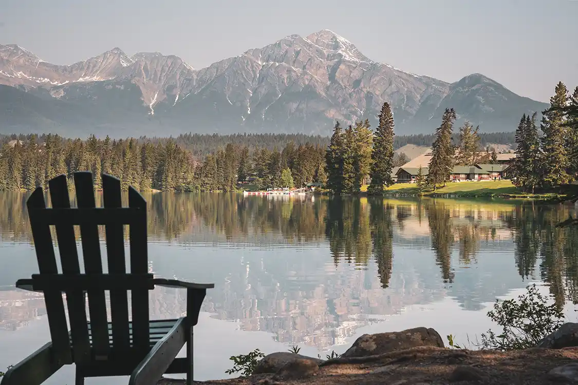
Two lakes within minutes of town, and the right answer on the afternoon when nobody can face getting back in the car.
Lac Beauvert sits beside the Fairmont Jasper Park Lodge, small enough to walk around in an hour, and it’s the most startling green water in the park. There’s a loop of about 2.1 km using the riverside trail and Lac Beauvert Road, though the road closes to vehicles in winter and there are exposed roots where the two meet. No public washrooms at the parking area, so go before you come.
Lake Annette is the swimming one. Shallow enough to actually warm up by late summer, with a sandy beach and a 2.4 km paved loop around it that has six rest areas built in. Worth knowing if that matters to you: three of those rest areas take a mobility device, some sections of the path slope up to 16 percent, and there’s a 40 m stretch with an unprotected edge drop of more than 60 cm. There are pit toilets with grab bars at both the swimming dock and the main lot. There’s no made route down to the water itself; the beach is reached across about 10 m of grass and then soft sand.
Both lakes reopened in 2025.
Stargazing In The Jasper Dark Sky Preserve
Jasper townsite and the entire park · Darkest from late August through winter · Allow an evening, or 45 minutes for a guided session
Jasper National Park is a Dark Sky Preserve, and it’s a big one. The Royal Astronomical Society of Canada gave it the designation in 2011, covering roughly 11,000 square kilometers, which makes it the second-largest dark sky preserve in the world. It’s the largest one you can drive into and sleep in, because there’s an entire town sitting inside the boundary with lighting bylaws written to keep the sky above it dark.
What that means on the ground is that you don’t have to earn the view. Most places with a sky like this make you drive an hour away from anywhere to find it. Here you can walk out of a hotel on Connaught Drive, drive seven minutes up to Pyramid Lake, and stand under the Milky Way.
I’ll tell you where we got this wrong, because it’s the easiest mistake to make on this trip. We drove this road in June, and in June Jasper barely gets dark. At this latitude in midsummer, twilight hangs on past 11 pm, so you’re waiting until nearly midnight for a sky that’s only ever going to be half dark, with tired kids and a long drive the next morning. If stargazing is something you actually want out of this trip, come in late August or September, or in winter. Autumn and winter nights here are long and properly black, and those are also the months when your odds of catching the northern lights are best.
The spots closest to town are good enough that there’s no need to go hunting. Pyramid Island, across that wooden bridge, is the classic, and having water in front of you doubles the sky. Lake Annette and Lac Beauvert both work well and are flat and easy to reach in the dark, which matters more than you’d think when you’re walking to a lakeshore at 11 pm. Old Fort Point gives you a higher vantage if you don’t mind the climb. For something properly remote, Maligne Lake is about an hour out and considerably darker, and the Columbia Icefield is darker still, though that’s a long way to drive at night on a road with elk on it.
You don’t have to do this on your own, and there’s a good argument for not. The Jasper Planetarium at the Fairmont Jasper Park Lodge runs guided sessions of about 45 minutes, with start times at 8:30, 9:45, and 11 pm. You get time on the telescopes when the sky is clear, a talk on what’s overhead and on the auroras, and the chance to hold a meteorite, which is exactly the sort of thing that holds a kid’s attention when a view won’t. Adult tickets run around $55 and youth around $30. Sundog Tours and the Jasper Adventure Centre both run dark sky and astronomy tours as well, including winter ones.
If you can time your trip around it, the Jasper Dark Sky Festival runs for about ten days in the second half of October, from the 16th to the 25th in 2026. It’s telescopes, talks, live music under the sky, and a run of events built for families, and it falls in the shoulder season when the town is quieter and the nights are already long.
How To Pace Your Banff To Jasper Drive
The hardest thing about driving between Banff and Jasper isn’t the driving. In fact, for the most part, the Banff to Jasper drive isn’t just beautiful; it’s also pretty easy. Smooth, good-quality roads, good traffic flow, and, apart from a few sharp turns in the mountains, not many challenges along the way. The real trouble comes from deciding what to leave out, and then admitting how long the things you kept are actually going to take. Here’s what I’ve learned after several drives, once as a couple with nothing but time and once with a full car, three generations and a dinner reservation.
- Choose two big stops before lunch. As much as we would all love to jam every hike and viewpoint in when driving between Banff and Jasper, the truth is, if you did, this drive would take a month. Set a realistic number of stops and understand how long each one will eat out of your day. Hit too many, and you could very well be pulling into Jasper after midnight.
- Pick your one can’t-miss per day and build around it. The Columbia Icefield tour, the Plain of Six Glaciers hike, the Spirit Island cruise, a soak at Miette. Each of those activities eats half a day, and each is worth half a day. Plan your days around one major experience so that you don’t end up getting caught up in the smaller sites and end up running out of time for the big ones.
- Be careful not to be drawn into too many long hikes. Bow Lake, Athabasca Falls, Sunwapta Falls, Medicine Lake, Lake Edith, and every pullout on the Parkway are all under 200 m on graded surfaces. You could do this entire drive without walking further than that and still see something astonishing at every stop. You could also stop at each of these and find yourself drawn into a 10-kilometer out-and-back hike. I highly recommend taking the time to do some of the incredible hikes in Banff or Jasper National Parks, but have a plan for them ahead of time. Don’t do them on a whim.
- Split the group rather than compromising. The mistake is finding one thing everybody can do at every stop, which will give you a day where nobody does what they wanted. Sunwapta is a good example: half the group can stand on the bridge at the upper falls, the other half can make the walk down to the lower falls, and everyone’s back at the car in forty minutes, having had a good time separately.
- Kids engage with mechanisms, not scenery. By the fourth turquoise lake, scenery stops working for some people. What held our boys was the sunken village under Lake Minnewanka, the lake that drains itself every autumn, rock flour explaining the color, and an all-terrain bus driving onto a glacier. Give kids something to understand, and you’ll get an hour out of them. Give them a view, and you’ll get ninety seconds.
- Remember to consider the altitude. Bow Summit sits at 2,068 m, and the walk up to the Peyto platform is the most strenuous thing most visitors do on this road. It catches people who thought they were just getting out for a look off guard.
- Bathrooms dictate the schedule more than you’d like. There is full plumbing at Lake Louise, Saskatchewan River Crossing, the Icefield Centre and Jasper. In most other places, expect port-a-potties and pit toilets with no sink everywhere else. Plan the gaps between those four, and you remove the only genuinely stressful part of this drive.
Driving The Banff To Jasper Route In An Electric Vehicle
No DC fast charging between Lake Louise and Jasper · One Level 2 charger in 232 km · Charge to full before you leave
There is no fast charging on the Icefields Parkway. Across the 232 km between Lake Louise and Jasper, there is exactly one place to plug in: a Level 2 unit at The Crossing Resort at Saskatchewan River Crossing. Level 2 gives you somewhere around 20 to 40 km of range per hour, which makes it a lunch stop and an emergency option rather than a charging strategy. It’s also seasonal, like everything else at the Crossing, so it isn’t there in winter at all.
Charge as close to 100 percent as you can manage in Canmore, Banff, or Lake Louise before you head north. Lake Louise has a pair of Tesla destination chargers at the ski resort shuttle station and a small unit in the village, and Banff has free Level 2 chargers scattered around town.
Jasper is where the real infrastructure sits. There’s a Tesla Supercharger with eight stalls on Connaught Drive near Balsam Avenue, open to NACS and CCS vehicles, along with three FLO DC fast chargers at the same site. One thing worth knowing before you count on anything else: the Parks Canada Level 2 chargers at 611 Connaught Drive went fleet-only as of 1 November 2026. If you’ve read somewhere that you can charge there, that’s no longer true.
Plan on losing range you wouldn’t lose at home. Lake Louise to Jasper is a net descent of roughly 480 m, but it climbs over Bow Summit at 2,068 m, and Sunwapta Pass at just over 2,000 m on the way, and those climbs cost you real battery. Driving the route in the other direction is a net climb the whole way. Add cold, which happens here on summer mornings, and highway speed on top of that, and losing 30 percent or more of your rated range is a reasonable expectation rather than a worst case.
As a rough guide: over 400 km of real-world range and you’ll make the drive without stopping to charge. Between 300 and 400 km, and you’ll still make it, but treat the Crossing as a planned stop rather than a backup. Under 300 km, you need to plan a multi-hour charge there in each direction, which in practice means cutting the number of stops you fit into that day.
Two last things. There’s no cell service across most of the Icefields Parkway, so your charging app won’t update while you’re driving. Check what’s working before you leave town. And when you stop for a wildlife jam or settle in at a viewpoint, don’t sit there with the climate control running. That’s the slow drain that turns a comfortable margin into an uncomfortable one.
A Word About The Canada Strong Pass
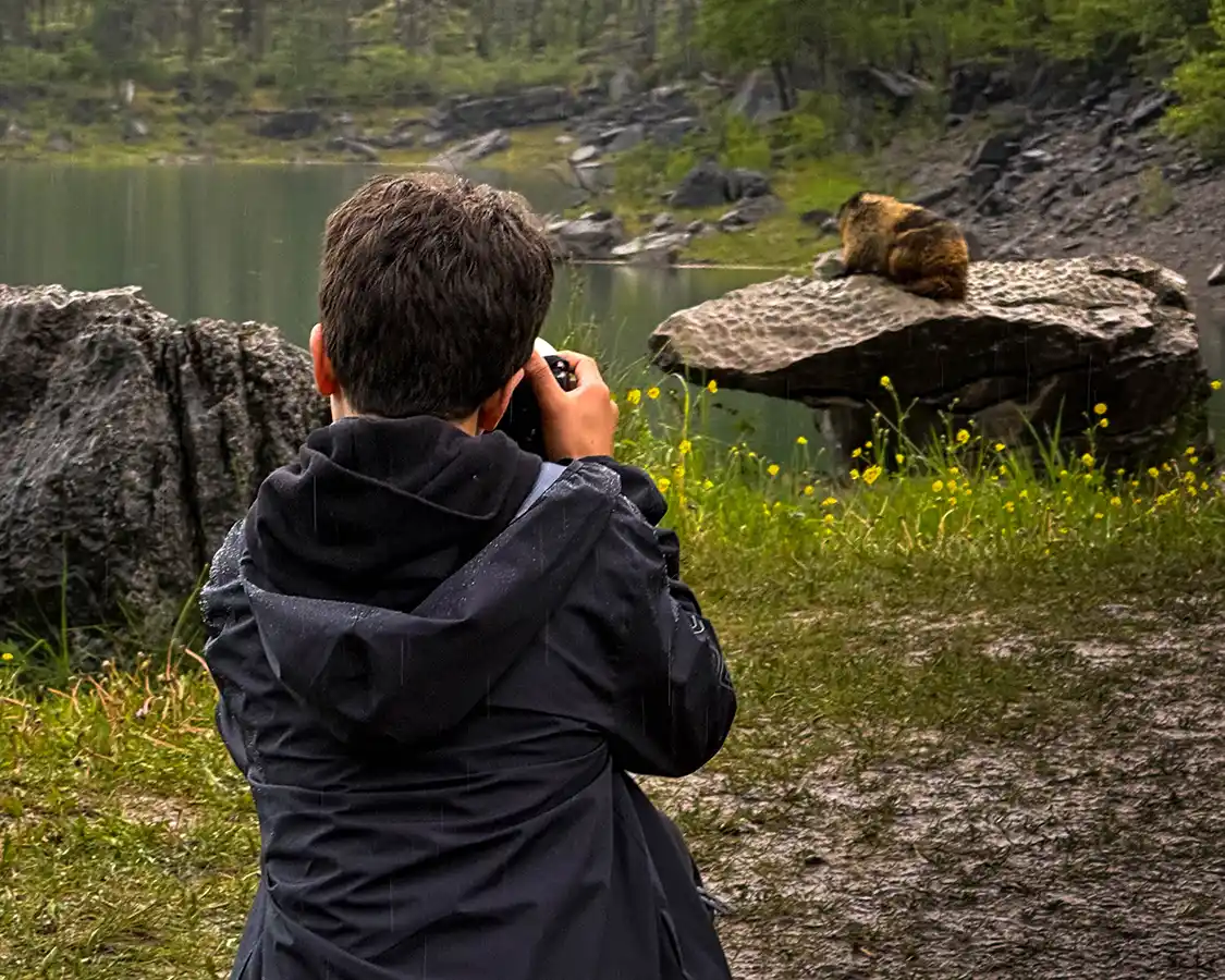
You need a Parks Canada pass to drive from Banff to Jasper. A daily family or group pass covers up to seven people in one vehicle, which for a group like ours is the best value going. The annual Discovery Pass breaks even at around seven days and is valid at more than 80 Canadian National Parks, Historic Sites, and Marine Parks nationwide. Buy it online, print it, and put it on the dash, because a screenshot on a phone is not reliably accepted at the gate.
On our first trip in 2006, we paid to get in. On this one, we didn’t, because entry was free nationwide from 19 June to 7 September 2026 under the Canada Strong Pass. That waiver has ended, and regular fees resumed on 8 September 2026, so if you’ve read anywhere that entry to Banff and Jasper is free, that information is out of date.
I’ll be honest. In my opinion, visiting Canadian National Parks should not be free.
On 20 October 2026, Parks Canada announced a second phase of cuts. Letters went to 2,917 employees, and the agency is working toward eliminating the equivalent of about 500 full-time positions to find $144.9 million in savings over three years, inside a broader federal plan to cut roughly 28,000 public service jobs by 2029. The union has been clear that those letters are not termination notices, and I’ll be equally clear about it, but the direction of travel is not in doubt.
The federal government spent a summer waiving the entrance fee to Banff, a park whose biggest problem is that too many people are already trying to get into it, while preparing to cut the staff who manage it. Lake Louise turns away three-quarters of the cars that try to park there. Moraine Lake had to be closed to private vehicles entirely. These aren’t places suffering from insufficient demand.
Here’s the complication, and it’s a real one that I don’t think resolves neatly. Drive 288 km north, and you reach a town where businesses name a lack of visitors as the single biggest obstacle to recovering from a fire that destroyed a third of it. The same policy that pours more people into an overrun Banff is doing something closer to triage in Jasper. One pass, opposite effects, at either end of the same road.
Which is maybe the argument for charging admission and spending it on the parks, rather than waiving it and cutting the people who look after them. I’d happily pay the fee. I’d rather the rangers and park staff kept their jobs.
Frequently Asked Questions About The Banff to Jasper Drive
Three and a half hours for the 288 km without stopping. Eight to ten hours if you stop properly, which is the entire point. Parks Canada suggests allowing three to four hours for the Icefields Parkway section alone before adding a single stop.
Yes. Leave Banff by 7 am, choose six stops and no more, and accept that you’ll arrive after dark in summer. If I had one day, I’d do Lake Louise, Bow Lake, Peyto Lake, the Columbia Icefield, Athabasca Falls, and Horseshoe Lake, and skip everything else without guilt.
Two is the honest minimum, with a night at Lake Louise or mid-Parkway. Three lets you add the Maligne Valley and Miette Hot Springs at the Jasper end. Five turns it into a proper Rockies trip rather than a transit.
Yes. Highway 93 North runs entirely inside Banff and Jasper National Parks, and there’s no through-traffic exemption. A daily family or group pass covers up to seven people in one vehicle. Buy it online in advance and print it.
One station, at Saskatchewan River Crossing, 108 km north of Lake Louise. It’s seasonal and closed in winter, and Parks Canada states there are no services at all across the 230 km between Jasper and Lake Louise in winter. Fill up before you start. There’s also no cell service on the Parkway.
No. Moraine Lake Road has been closed to personal vehicles year-round since 2023. You get there by Parks Canada shuttle from the Lake Louise Park and Ride, by Roam Transit Super Pass starting in Banff, with a licensed commercial operator, as a registered Moraine Lake Lodge guest, or by bicycle. Shuttle reservations open in mid-April, but only 40 percent of seats are released that day; the other 60 percent go on sale at 8 am MDT two days before each departure.
Yes, and it would like you to come. About 97 percent of Jasper National Park was unaffected. More than 25 accommodations, 70 restaurants, and 50 experiences are operating. The townsite is actively rebuilding, so expect construction, particularly in the west end.
Maligne Canyon, to all activity year-round, including the ice walks, with no reopening date. Mount Edith Cavell and Cavell Road, until further notice. Whistlers and Wabasso campgrounds. Opal Hills Trail, for bear activity. Maligne Lake, Medicine Lake, Pyramid, Patricia, Edith, Annette, Athabasca Falls, Sunwapta Falls, Miette Hot Springs, and the Jasper SkyTram are all open.
It’s open year-round but closes unpredictably for avalanche control and weather, sometimes for a full day. Winter tires or chains are legally required from 1 November to 31 March; plowing runs only 7 am to 3:30 pm, and Parks Canada actively advises against using it as a Trans-Canada alternative in winter. Check 511.alberta.ca before you go, in any season.
Late June through September for full access, with everything open and the Parkway at its most reliable. We went in June, which meant heavy snow still on the peaks, waterfalls at full snowmelt volume, and water too cold to swim in. September gives you fewer people and better light. July and August give you everything open and everyone else there too.
Yes, and better than almost any comparable road trip in the world. Most of the great viewpoints on the Parkway sit under 200 m from the car on made surfaces, the Lake Louise lakeshore path is paved and flat, and the Peyto Lake platform is the one genuine uphill. If mobility is a consideration, accessible shuttles at Lake Louise are dispatched on demand with a maximum 30-minute wait. Build your day around the walk-from-parking distances in this guide rather than the trail descriptions, and you will still see the best of it.
Is The Banff To Jasper Drive Worth It?
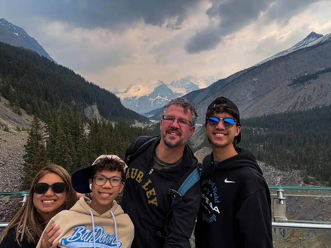
Twenty years ago I drove this road with my fiancee, Christina. We had a cheap rental and a cheaper camera and almost no idea what we were going to do. This summer I drove it again; Christina was now my wife of 19 years, and we had our two sons and her parents join us. This time, I had a much better camera, and a far clearer sense of just how special the Banff to Jasper drive is.
Things have changed over those twenty years. Some things have gotten harder. You can’t park at Moraine Lake. You can’t sit on the rocks at the Athabasca Glacier, the pikas won’t come out to play, and Maligne Canyon and Mount Edith Cavell are shut. But many things have been made much better. The viewpoints hold the crowds that now come. There is hardly any great view on this road that somebody with mobility issues can’t reach.
What hasn’t changed at all is the beauty of the Canadian Rockies. You still come crest a rise and find a glacier hanging off a mountain like it’s been bolted there. The water is still a color of blue that doesn’t seem possible. And there are still places to visit, if you’re willing to drive past the famous ones, where you can sit on a rock by a lake without anybody telling you where to stand. We found one, twenty-five kilometers short of Jasper, and I know that if you want one, you’ll find one too. You just have to be willing to stop at the places that the signs don’t point everyone else to.
If you’re building a bigger Alberta trip around this, start with my Banff family travel guide and the guide to where to see wildlife in the Canadian Rockies. For more in the same vein, I’ve also written up Canada’s most unforgettable road trips, the best family hiking destinations, a guide to Canada’s national parks, and the most amazing places in Canada.
Have you driven the Icefields Parkway? Tell me about it in the comments, and if you’ve got a photograph of somewhere from twenty years ago, I’d genuinely like to see it. And if you make it to Horseshoe Lake before I get back there, please don’t tell too many people.
Disclosure: Pursuit provided our family with Pursuit Passes covering the Banff Gondola, an open-top tour in Banff, and the Columbia Icefield tour. They had no editorial input and did not see this article before it was published. This article also contains affiliate links. If you book accommodation or a tour through one of them, Wandering Wagars may earn a small commission at no extra cost to you. All opinions are my own.
You May Also Like To Read