The best way to see Canada is by hopping in the car and driving. Hit the road on these 12 unforgettable Canadian Road Trips!
At 9.985 million km², Canada is the world’s second-largest country. For visitors looking to explore this incredible place, it can be daunting deciding where to get started. There is no doubt that the best way to see Canada is up close and personal.
There’s no better way to get a taste for this country than by hopping in a car or RV and hitting the road. To help whet your appetite for exploring our home country, we’ve jotted down some of the most unforgettable Canadian Road trips. One for every province and territory except Nunavut, as there are currently no roads connecting it to the rest of the country … yet.
Icefields Parkway in Alberta
Table of Contents
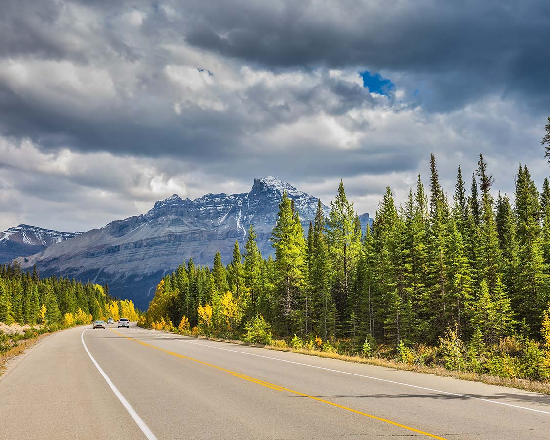
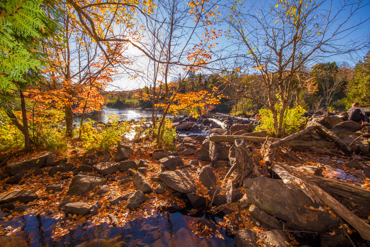
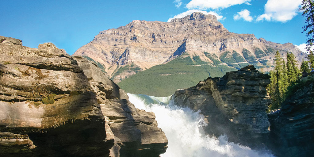
The Icefields Parkway is a 230 km stretch between Banff and Jasper, Alberta along HWY 93N. Most visitors start in the city of Calgary and continue to Banff and Jasper from there (412 km). During the drive, you’ll experience the spectacular Rocky Mountain scenery including waterfalls and emerald-colored lakes. You’ll also have a very good chance to see local Alberta wildlife such as black bears, grizzly bears, moose, and bighorn sheep. With all these mountains and wildlife, it’s definitely one of our favorite unforgettable Canadian Road Trips.
Best time to visit the Icefields Parkway
The Icefields Parkway is open year-round, but the best time to drive around is during the warmer months from May-October. All services, such as fuel and accommodations are closed between November and April, and driving during snowy months can be precarious.
How much time to best experience the drive
Although the drive in both directions can be done in a day, to fully experience this incredible region it is best to dedicate a few days to a week, with nights in Banff, Jasper, and Lake Louise. You may even get a chance to see the elusive Grizzly Bears, one of our coolest wildlife experiences here in Canada.
What to see along the Icefields Parkway in Alberta
During your drive along the Icefields Parkway in Alberta, make sure to experience these incredible sights:
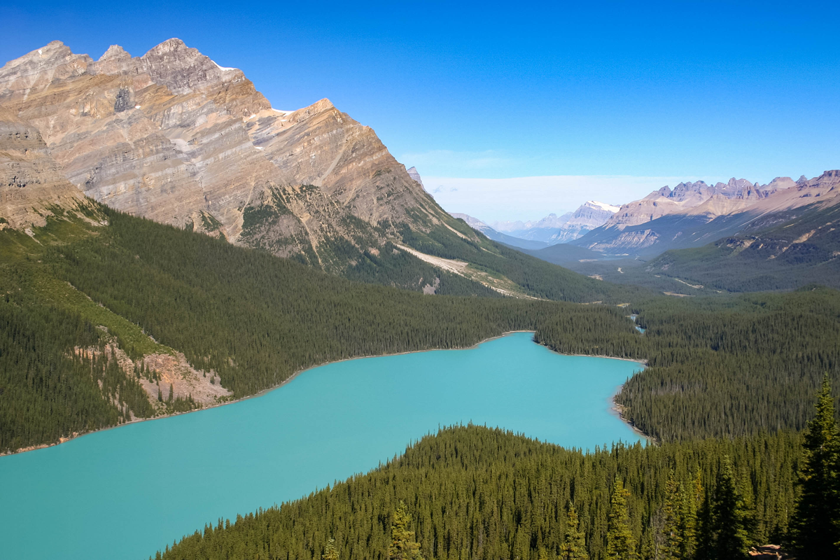
- Let your jaw hit the floor with the view of Peyto Lake from Bow Summit
- Experience the magical views of Mistaya Canyon
- Check out the incredible waterfalls of the Weeping Wall
- Get your iconic Parks Canada photo at the Wilcox Pass Red Chairs
- Put on your crampons to walk on the incredible Athabasca Glacier at the Columbia Icefields.
- Take in the views of the Seven Sisters from Lake Moraine
- Take a canoe ride in beautiful Lake Louise
- Test your fear of heights with the Jasper Glacier Skywalk
- Take in Tangle Falls, the most photographed waterfall on the Icefields Parkway in Alberta
- Stop for lunch or camping in Sunawpta Falls
- Hike and feel the power of the Athabasca Falls
- Hike the Valley of the 5 lakes
- Visit the peak of the Whistler Mountains on the Jasper Sky Tram
Find the best prices and availability for hotels near the Icefields Parkway here:
Booking.com
Sea to Sky Highway in British Columbia
The Sea to Sky Highway in British Columbia has long been considered to be one of the world’s greatest drives. It was a shoo-in for a spot on our list of unforgettable Canadian road trips.
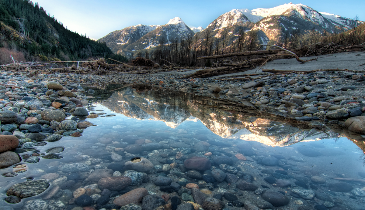
This route, along HWY 99 between Vancouver and Whistler features stunning ocean vistas, towering Rocky mountains, and spectacular waterfalls.
Best time to visit the Sea to Sky Highway
The Sea to Sky Highway is best experienced in late spring to early fall months when the blue sky reflects on the ocean. The warm weather will give way to cooler temperatures as you climb through the mountains to the snow-covered peaks of Whistler.
How much time to best experience the drive
The Sea to Sky Highway is a 134 km journey and can be done in a couple of hours. But with all of the amazing experiences to see along the way it’s ideal to give a full day to two days for each direction if you plan on experiencing the hikes and attractions in detail. It may be the most popular of all the Canadian Road Trips.
What to see along the Sea to Sky Highway in British Columbia
There is no lack of things to see on the Sea to Sky Highway in British Columbia, but here are a few things that we highly recommend.
- Experience the village feel of Granville Island in Vancouver. Make sure to check out the incredible street art and try the craft brewery
- Take in the coastal beauty and incredible totem poles during a hike through Stanley Park
- Check out the viewpoint at Lighthouse Park where Burrard Inlet meets the Howe Sound
- Take in the sea lions at Whytecliff Park
- Take in the views of Paradise Valley from Mount Tantalus at the Tantalus Range Lookout
- Hike or take the Sea to Sky Gondola in Squamish
- Discover Brandywine Falls and Swim Lake in Squamish
- Hike through the Whistler Train Wreck. But don’t walk on the tracks, you could be fined.
Find the best prices and availability for hotels near Vancouver, B.C. here:
Booking.com
Winnipeg to Brandon Manitoba Through Spruce Woods Provincial Park
The route from Winnipeg through Brandon Manitoba to Spruce Woods Provincial Park Is a 260 km trip through the towns of Douglas and Carberry. While it’sa long Canadian road trip, this drive isn’t lacking in views! As far as Canadian Road Trips go, this one is one of the most unique. And it gives a great impression on how majestic and diverse the Canadian prairies are.
Best time to visit Spruce Woods Provincial Park
Spruce Woods is best visited in the summer when the colors of the beautiful landscape really stand out, but there are snowmobile trails available for those visiting in the winter.
How much time to best experience the drive
The drive between Brandon and Spruce Woods Provincial Park can be done in a couple of hours, even with stops along the way.
What to see between Brandon and Spruce Woods Provincial Park
- Check out the vintage airplanes and equipment at the Commonwealth Air Training Plan Museum
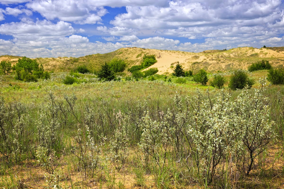
- Hike the sand dunes and smell the flowers on the Spirit Sands Trail
- Canoe on the Assiniboine River
- Watch the birds in the blue water of the Devil’s Punch Bowl
Find the best prices and availability for hotels near the Brandon, Manitoba here:
Booking.com
Fundy Coastal Drive in New Brunswick
Home to the world’s highest tides, the Fundy coastal drive in New Brunswick offers views of the stunning coastline between St. Stephen and Moncton. The scenic drive offers the chance to see whales breaching in the Bay of Fundy and of course witness one of the world’s most recognizable natural arches. Along with being one of the best Canadian Road Trips, it’s also one of the top bucket list destinations in Canada.
Best time to visit Fundy National Park
The Bay of Fundy is best traveled during late spring to early fall months, as winter access to many of the areas features is restricted. It’s also important to note the expected tides. They run in 6-hour and 13-minute intervals, so timing your trip can mean witnessing the incredible 22-foot change in coastal depth.
How much time to best experience the drive
The Fundy Coastal Drive snakes the length of the southern shore of New Brunswick along Routes 114 and 111. The entire drive is a 391 km trip through quaint villages and beautiful parks. To get the most out of the trip, we recommend at least two days to make the trip.
What to see along the Fundy Coastal Drive in New Brunswick
The Fundy Coastal Drive offers some of the best views in New Brunswick. Here are some of our favorites.
- Explore the historic town of St. Stephen. Make sure to visit the Chocolate factory
- Feel the wind in your face in your face near the lighthouse at the peak of Cape Enrage
- Take in the New England charm of St. Andrews by the Sea
- Take a boat to Grand Manan Island. While you’re here, take in views of over 300 bird species
- Camp and/or hike through Fundy National Park
- Walk the suspension bridge over Big Salmon River
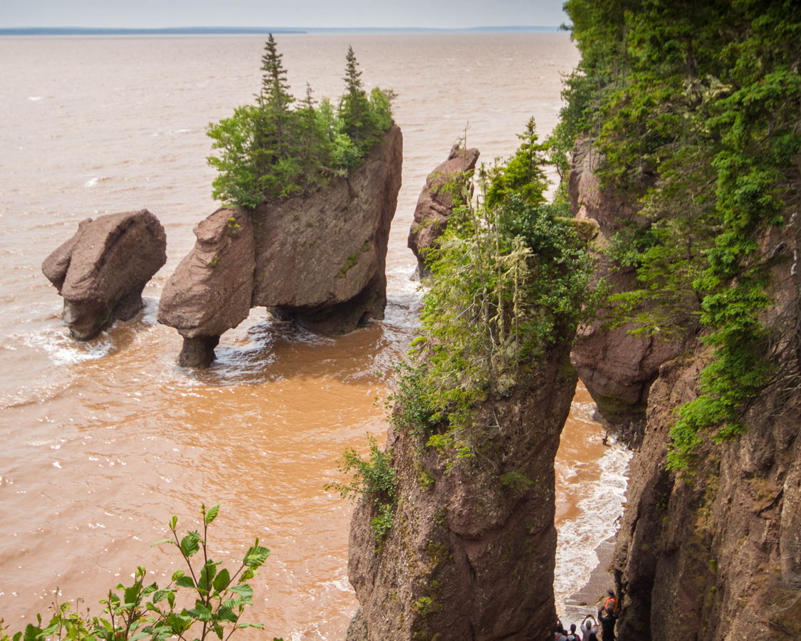
- Experience the world’s highest tides at Hopewell Cape
Find the best prices and availability for hotels near the Fundy National Park here:
Booking.com
The Newfoundland Viking Trail
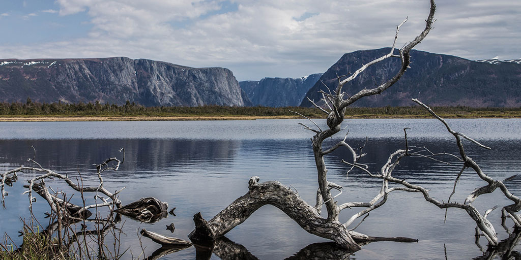
Winding along the west coast of the maritime province of Newfoundland is one of the most historic of the Canadian Road Trips. The historic Viking Trail takes you through beautiful Gros Morne National Park up through l’Anse aux Meadows to the town of Twillingate. Along the way, you’ll experience some of the most majestic scenery east of the Rocky Mountains.
Best time to visit the Newfoundland Viking Trail
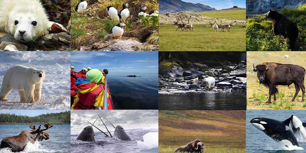
The Newfoundland Viking Trail is open year-round. The spring to fall months offer incredible views and easy access to hiking trails, while the winter months give access to snowmobiling, snowshoeing and winter hikes through the snow. Our favorite time to visit is in the spring where you have an excellent chance to see whales, moose, elk, and of course, the amazing Icebergs in Iceberg Alley.
How much time to best experience the drive
The Newfoundland Viking Trail begins in Deer Lake and winds for 489 km along the west coast of the province to the northern tip of Twillingate. The drive can be done in a day covering both directions. But if you want to explore the incredible hikes and beautiful scenery, we recommend at least two to three days or more to explore the region.
What to see along the Newfoundland Viking Trail
The Newfoundland Viking Trail is like a time machine. It brings you from the beginnings of the planet, through ancient native burial grounds, millennia-old Viking settlements and through quaint historic fishing towns. These are some of our favorite stops.
- Hike the only place in the world that you can walk on the earth’s Mantle at Tablelands in Gros Morne National Park
- Walk on the beach in the town of Trout River
- Discover the art scene in Woody’s Point
- Hike up Gros Morne Mountain to take in the views
- Search for whales near the lighthouse at Lobster Head Cove
- Search for gnarled driftwood in Shallow Bay
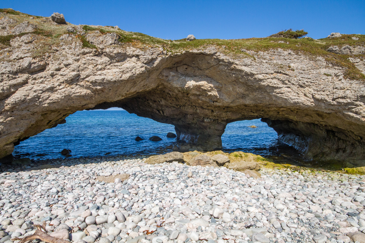
- Explore spectacular Arches Provincial Park
- Join the boat tour of Western Brook Pond and gape at the massive cliffs
- Feel the wind on your face at the ancient aboriginal grounds in Port au Choix
- Walk through the Viking settlement display at l’Anse aux Meadows National Historic Site
- Search for Icebergs at the tip of Iceberg Alley in Twillingate
Find the best prices and availability for hotels near Twillingate, Newfoundland, and Labrador here:
Booking.com
The Cabot Trail in Nova Scotia
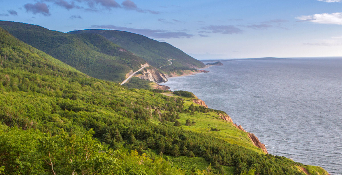
One of the world’s most iconic drives is the Cabot Trail in Nova Scotia. This 300 km loop snakes around Nova Scotia and through the Cape Breton Highlands. The Cabot Trail offers jaw-dropping coastal views and some of the best Celtic and Acadian hospitality that Canadian Road Trips have to offer.
Best time to visit the Cabot Trail
The Cabot Trail is open year-round. Late spring to early fall is ideal due to the warmer temperatures and better wildlife spotting, but any time is a great time to drive the Cabot Trail in Nova Scotia.
How much time to best experience the drive
The Cabot Trail could be done in a day, but if you really want to experience the stops and take in the gorgeous scenery, we recommend taking at least two to three days. Ingonish is a great place to stay to break up your trip.
What to see along the Cabot Trail in Nova Scotia
Cabot Trail isn’t just a wonderful drive with immensely scenic views. The trail has incredible hikes, beautiful nature, and cozy towns to experience as well!
- Discover all the colors of the wonderful town of Baddeck
- While in Baddeck visit the Alexander Graham Bell National Historic Site
- Hike the coastal wilderness of the Cape Breton Highlands National Park (a park entry permit is required for anything beyond driving through the park)
- Hit the sandy beach in Ingonish
- Climb the rocks and watch the lobster fishermen from Lakies Head
- Learn about the areas Scottish roots in Lone Shieling
- Wade in the babbling waterfalls or enjoy a picnic at Macintosh Brook
- Watch whales breaching from Pleasant Bay or get to the top of MacKenzie Mountain for some amazing overlooks of the bay at the trail
- Hike the Skyline Trail. Look out for moose, bears, whales, and eagles.
- Learn to boil a lobster in Cheticamp
Find the best prices and availability on hotels near Cheticamp, Nova Scotia here:
Booking.com
The Dettah Ice Road in the Northwest Territories
Just outside of the capital of Yellowknife in the Northwest Territories is a road unlike any others on this list. This experience isn’t hundreds of kilometers long or winding along coastal planes. Instead, the Dettah Ice Road in the Northwest Territories takes you along the edge of Canada’s second-largest (and deepest lake), Great Slave Lake. Even more unique, this road, between Yellowknife and the First Nations town of Dettah, isn’t made of asphalt. Instead, you will be driving directly on the thick ice of the lake itself!
Best time to visit Yellowknife
It may seem obvious by the name, but just in case, the best time to drive the Dettah Ice Road in the Northwest Territories is in the winter. The road is usually opened to light truck traffic in February and remains open until early April. Driving from Yellowknife to Dettah during the summer can be done, but you will need to take the 27 km asphalt route instead of the 6 km ice route.
How much time to best experience the drive
The Dettah Ice Road in the Northwest Territories is a short 6 km jaunt, but it is good to give some time to visit the town of Dettah and learn about the local Indigenous community as well.
What to see along the Dettah Ice Road in the Northwest Territories
The Dettah Ice Road in the Northwest Territories has a lot more to offer than just ice. During the drive make sure to check out these places:
- See the majestic wood buffalo at the Mackenzie Bison Sanctuary
- Go ice fishing on Great Slave Lake
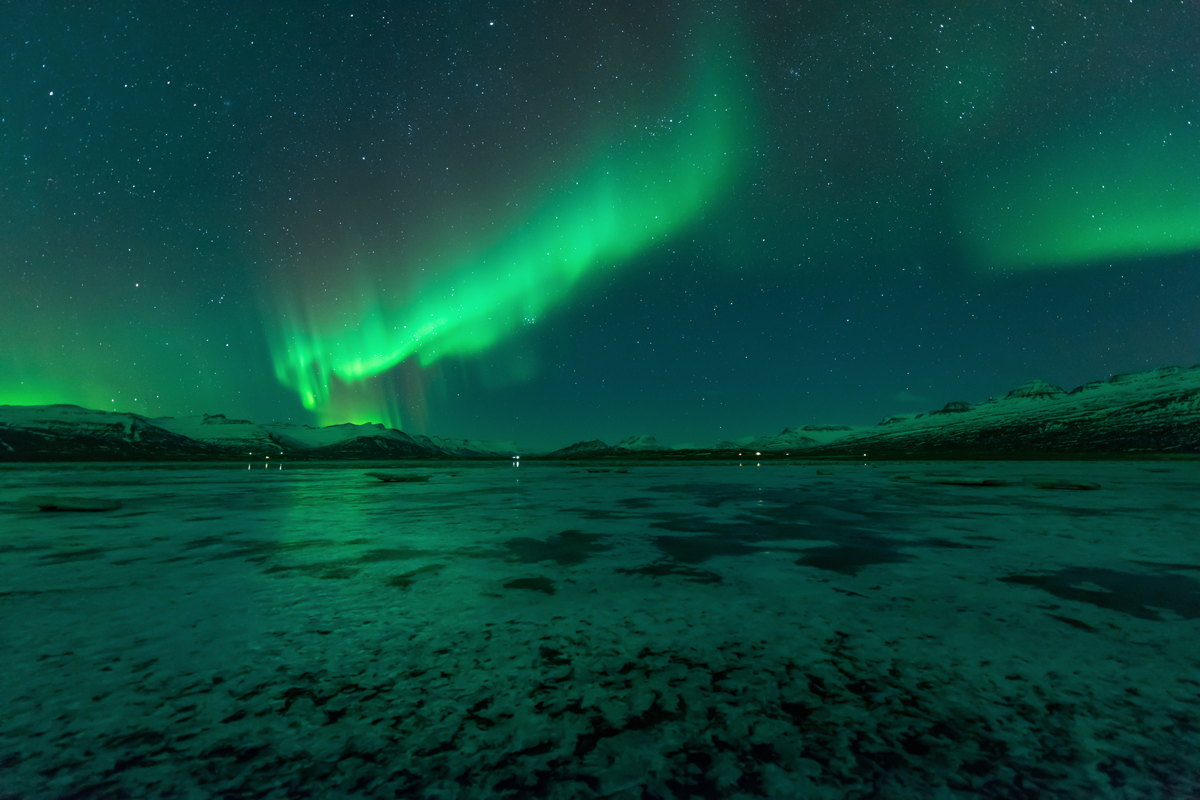
- Take in the Northern Lights from a unique perspective
You can read more about our experiences in Yellowknife NWT here. Find the best prices and availability on hotels near Yellowknife, Northwest Territories here:
Booking.com
The Muskoka Cottage Country Trail in Ontario
Just a 2-hour drive north of Toronto, the popular Muskoka region has long been considered the go-to weekend getaway for those in the city. This popular destination offers countless lakes, rivers, and beaches for visitors and locals alike to explore.
Best time to visit Muskoka, Ontario
The Muskoka cottage country has activities for those who want to visit year-round. The summer offers beautiful skies and lakes perfect for a swim, while the winter lets you strap on your snowshoes or cross-country skis for some incredible wilderness exploration. But our favorite time to visit is during the fall when the tree colors explode into a rainbow and the leaves crunch under your shoes.
How much time to best experience the drive
A road trip through the Muskoka cottage country can be accomplished in a day, but we recommend taking two days to experience the hikes and sites. While you’re there, enjoy a night in Gravenhurst, Bala or Huntsville.
What to see along the Muskoka Cottage Country Trail
The Muskoka cottage country is full of spectacular nature, waterfalls, and scenery, the drive alone is worth the visit, but here are some of our favorite places to explore.
- Walk the boardwalk or ride a 130-year-old steamship in the town of Gravenhurst
- Explore the Johnstons cranberry marsh or if you visit in mid-October, the Cranberry Festival in Bala
- Hike over the rocks of Ragged Falls and explore the fall colors
- Climb the Dorset Fire Tower to get breathtaking views of the surrounding forests.
- Check out the horseshoe bend at Arrowhead Provincial Park
Find the best prices and availability on hotels near Gravenhurst, Ontario here:
Booking.com
The North Shore of Prince Edward Island
At 5,660 km², Prince Edward Island is Canada’s smallest province. This scenic island, situated in the Gulf of St. Lawrence has long been a popular destination for those who love exploring picturesque towns and feasting on fresh seafood. While road-trips are the most popular way of exploring, the question is where to start, and our favorite drive is along the North Shore of Prince Edward Island.
Best time to visit Prince Edward Island
Prince Edward Island can be explored year-round, but to take advantage of the beautiful red sand beaches, we recommend visiting before the Labour Day holiday in September. After this holiday, many of the attractions are closed.
How much time to best experience the drive
To drive the north shore of Prince Edward Island, we recommend giving yourself at least 2 days, or up to a week if you want to explore deeper into the province.
What to see along the North Shore of Prince Edward Island
From culture to scenery, the North Shore of Prince Edward Island has it all. Here are a few of our must-do activities when we visit.
- Enjoy the worlds best oysters in Malpeque Bay
- Visit the set of the famous Anne of Green Gables
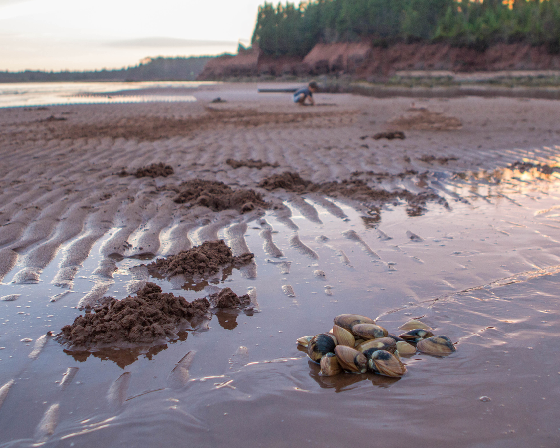
- Dig for clams on the beach of Cavendish Campground
- Discover the scenic North Rustico Harbour Lighthouse
- Hit the red sand beaches along the Gulf Shore Parkway
Find the best prices and availability on hotels on Prince Edward Island here:
Booking.com
The Gaspe Peninsula in Quebec

The Gaspe Peninsula in Quebec is an epic 755 km route from Quebec City to the town of Perce where the St. Lawrence River empties into the Gulf of St. Lawrence. The route takes you through inspiring indigenous communities and quaint French towns, along the spectacular St. Lawrence River and up to one of the most scenic points in Eastern Canada. For those looking for a truly epic route, you can start with the Toronto to Quebec City drive.
Best time to visit the Gaspe Peninsula
The drive along the Gaspe Peninsula from Quebec City to Gaspe is open year-round, but many of the small towns are quiet during the winter. Our favorite time to drive along the St. Lawrence River in Quebec during early July and August, just outside the construction holiday when things can be very busy.
How much time to best experience the drive
The drive from Quebec City to Gaspe can be done in two days, however, to properly explore the region, we suggest giving at least 4-5 days to make the most of it.
What to see along the St. Lawrence Waterway in Quebec
Every km of the route along the St. Lawrence River is a moment to be treasured, but here are a few of our top spots.
- Stop in Parc de la Chute-Montmorency to take in the incredible 83-meter Montmorency Falls.
- Admire the amazing architecture of the Sainte-Anne-de-Beaupre shrine
- Grab some local cheese in Poterie de Port-au-Persil
- Watch the whales on a boat tour of the St. Lawrence River
- Visit the picturesque town of Perce and witness stunning Perce Rock at sunset
- Hike through Ile Bonaventure to surround yourself with thousands of Northern Gannets
You can read more about Perce and the Gaspe Peninsula here. Find the best prices and availability on hotels in Perce, Quebec here:
Booking.com
Estevan to Swift Current Saskatchewan
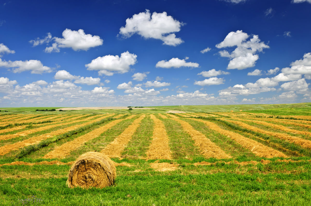
With endless skies and vast fields, the Canadian prairies in Saskatchewan make for a breathtaking journey. A road trip between the cities of Estevan and Swift Current can give you a taste of what this beautiful province has to offer!
Best time to visit Swift Current Saskatchewan
The prairies in the winter can be a bit on the frigid side, so we recommend visiting in the late spring to early fall to get the most spectacular colors and the most out of your drive.
How much time to best experience the drive
The drive from Estevan to Swift Current Saskatchewan takes about 4 hours, but we recommend taking the entire day in order to ensure you can make the most of the sites on the way.
What to see between Regina and Swift Current Saskatchewan
- Visit the set of the famous Corner Gas TV show in Rouleau on the highway between Weyburn and Moose Jaw
- Wade in the river of the Wakamow Valley
- Get close to nature at Buffalo Pound Provincial Park
- Check out Mac the Moose, because it’s a giant moose
Find the best prices and availability on hotels near Swift Current, Saskatchewan here:
Booking.com
The Dempster Highway in the Yukon Territories
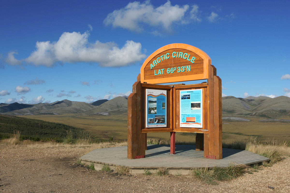
The Dempster Highway in the Yukon Territories could be one of the most epic of the unforgettable road trips in Canada. The Dempster Highway is the only all-weather road in Canada to cross over the Arctic Circle, and driving it is something you will never forget! This unpaved, two-lane road is a challenging route across the tundra, filled with wildlife and unmatched views.
Best time to visit Dawson City, Yukon
The Dempster Highway in the Yukon Territories is well-maintained and accessible year-round, but the route on a good day can is remote and challenging, so driving from mid-spring to late fall will allow you some daylight to enjoy the views and warmer temperatures to make hiking and exploring more comfortable. But if your goal is to see the Northern Lights, pack those layers and hit the Dempster Highway in the winter.
Remember that the Dempster Highway in the Yukon Territories is remote. The 742 KM road has services in Dawson City (KM 0, Eagle Plains (KM 370), Fort McPherson (KM 555), and Inuvik (KM 742).
How much time to best experience the drive
Although the road can be driven in a day, it is best to give yourself a week to fully experience the Dempster Highway in the Yukon Territories. Remember to bring extra gas, a shovel and enough supplies for an emergency. The Dempster Highway in the Yukon territories does not see a lot of traffic.
What to see along the Dempster Highway in the Yukon Territories
The views along the Dempster Highway are legendary, here are a few of our favorite things to check out
- Hike to catch a glimpse of the incredible Tombstone Mountain
- Canoe or Kayak in Blackstone River
- Take in the views of the mountains at Ogilvie Ridge
- Grab a snap when you cross into the Arctic Circle (KM 405)
- Hike around Rock River Yukon Campground. It offers some beautiful scenery
- Check out the Igloo Church in Inuvik
Find the best prices and availability on hotels near Dawson City, Yukon here:
Booking.com
What’s keeping you from experiencing one of these unforgettable Canadian Road Trips?
Canada is epic, and these are just a few of the incredible drives you can take to experience this beautiful country. So get out and explore Canada this year! And if you have a favorite Road Trip in Canada, let us know in the comments!
This post may contain compensated links. For more information please read our disclaimer. Wandering Wagars is a participant in the Amazon Services LLC Associates Program, an affiliate advertising program designed to provide a means for sites to earn advertising fees by advertising and linking to amazon.com, amazon.co.uk, amazon.ca. Amazon and the Amazon logo are trademarks of Amazon.com, Inc. or its affiliates.
You May Also Like To Read:

Puneeta
Tuesday 26th of February 2019
What an epic list! My hubby and I have 4 of the 12. 8 more to go, I guess
Kevin Wagar
Tuesday 26th of February 2019
That's a pretty great start! I'd love to know your favourites so far.
Rob+Ann @TravelLatte(.net)
Sunday 25th of June 2017
We've been debating the best way to tackle Canada, and I think we just found our answer! Thanks for the great ideas!
Ray
Friday 10th of March 2017
The Sea to Sky Highway has been my favourite road trip to date. While I agree with your suggestions of what to see and do in Vancouver, I would actually treat Vancouver as a separate visit altogether (4 - 5 days) and just focus your time on the highway itself (1 - 2 days). Squamish is a nice town to break up the drive between Vancouver and Whistler. I was only there for about a half hour to fill up on gas and to get a quick bite to eat. I definitely would have loved to have seen more of Squamish as it was just so tranquil and peaceful there.
Kevin Wagar
Sunday 12th of March 2017
I can't argue that Vancouver is certainly a destination into and of itself! Thanks for the helpful tips!
Cez of eTramping
Thursday 16th of February 2017
Those photos just sort of take your breath away, wow. Would love to make it out there, thanks for the post!
Yulie buyong
Wednesday 15th of February 2017
Hi beautiful pictures And I am pretty sure Canada is very fun country. I would like to go for road trip there.